You are using an outdated browser. Please
upgrade your browser to improve your experience.
Monitoring weather disturbances, and their corresponding hazards, has now been made easier

NOAH PH
by Pointwest Technologies Corp.

What is it about?
Monitoring weather disturbances, and their corresponding hazards, has now been made easier.
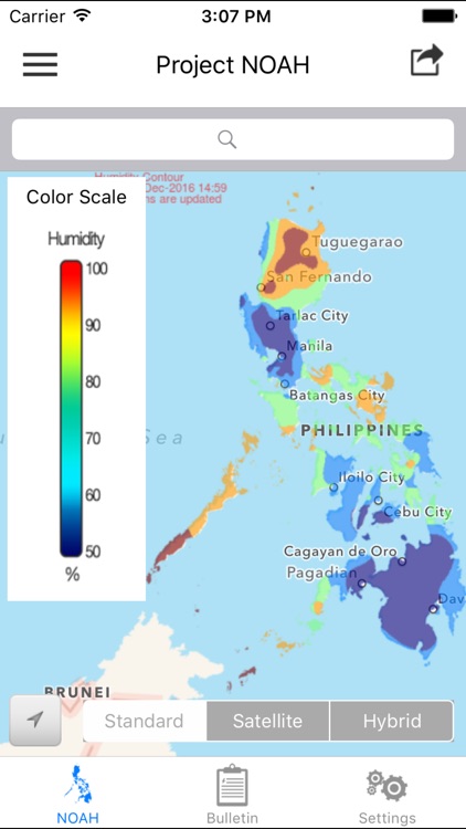
App Screenshots
App Store Description
Monitoring weather disturbances, and their corresponding hazards, has now been made easier.
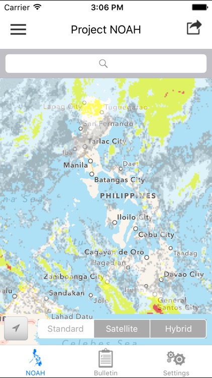
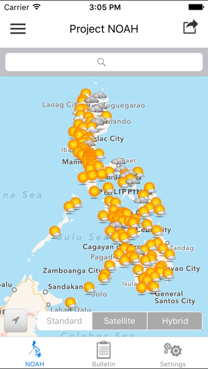
• Get updates on rain and weather outlooks for different Philippine cities
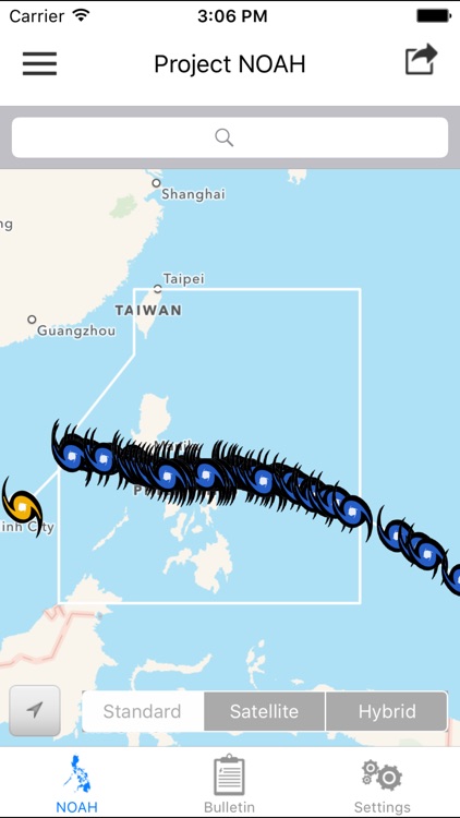
• View satellite images of typhoons in the Philippine Area of Responsibility
• See actual and forecasted typhoon positions
• Check water levels of streams all over the country
• View recorded rainfall amounts in the past 24 hours
• See areas with possible flooding and landslides due to heavy rain
• Share NOAH's information easily to your social media accounts
This is the official iOS app version of the Nationwide Operational Assessment of Hazards (Project NOAH) website (http://noah.dost.gov.ph). The companion app to ARKO (the mobile app for flood, storm surge, and landslide hazard maps), the NOAH iOS app features a user-friendly interface that allows you to view near real time weather information, which can help prevent and mitigate disasters.
This mobile app was improved by Pointwest in cooperation with Project NOAH. Content and data come from the Department of Science and Technology (DOST) and its participating agencies.
Project NOAH’s mission is to undertake disaster science research and development, advance the use of cutting edge technologies and recommend innovative information services in government's disaster prevention and mitigation efforts. Though the use of science and technology and in partnership with the academe and other stakeholders, the DOST through Program NOAH is taking a multi-disciplinary approach in developing systems, tools, and other technologies that could be operationalized by government to help prevent and mitigate disasters.
FEATURES:
Layers
1. Philippine Area of Responsibility (PAR)
2. Weather Outlook
a. 4-Hour Rain Forecast
b. PAGASA Cyclone Update
3. Satellite
a. HIMAWARI IR
b. HIMAWARI IR (Colorized)
c. HIMAWARI + GSMAP
d. GSMAP 1hr Rainfall
e. GSMAP 3hr Rainfall
f. GSMAP 6hr Rainfall
g. GSMAP 12hr Rainfall
4. Contour
a. 1-Hour Rainfall Contour
b. 3-Hour Rainfall Contour
c. 6-Hour Rainfall Contour
d. 12-Hour Rainfall Contour
e. 24-Hour Rainfall Contour
f. Temperature Contour
g. Pressure Contour
h. Humidity Contour
3. Doppler
a. PAGASA RADAR Mosaic
b. Aparri Station
c. Baguio Station
d. Baler Station
e. Cebu Station
f. Guiuan Station
g. Hinatuan Station
h. Subic Station
i. Tagaytay Station
i. Tampakan Station
i. Virac Station
4. Sensors
a. Weather Stations
b. Stream Gauges
c. Rain Gauges
d. Rain and Stream Gauges
d. Tide Levels
* switchable between three base maps (Standard, Satellite and Hybrid)
* share screenshot (in almost all views) or text contents (News) via applications (Facebook, Twitter, Mail)
* supports animated overlays (HIMAWARI, Doppler, Chance of Rain)
* very flexible Settings
Disclaimer:
AppAdvice does not own this application and only provides images and links contained in the iTunes Search API, to help our users find the best apps to download. If you are the developer of this app and would like your information removed, please send a request to takedown@appadvice.com and your information will be removed.
AppAdvice does not own this application and only provides images and links contained in the iTunes Search API, to help our users find the best apps to download. If you are the developer of this app and would like your information removed, please send a request to takedown@appadvice.com and your information will be removed.