You are using an outdated browser. Please
upgrade your browser to improve your experience.

This app is the one time purchase version of OilTrails, no subscription required

OilTrails Unlimited
by Ash Point Ltd.


What is it about?
This app is the one time purchase version of OilTrails, no subscription required. All the same features, unlimited use.
App Screenshots


App Store Description
This app is the one time purchase version of OilTrails, no subscription required. All the same features, unlimited use.
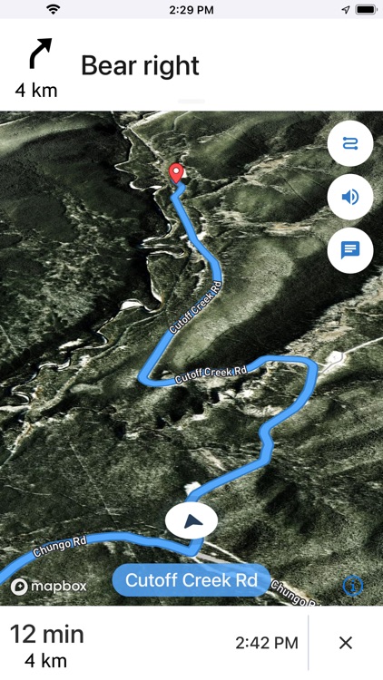
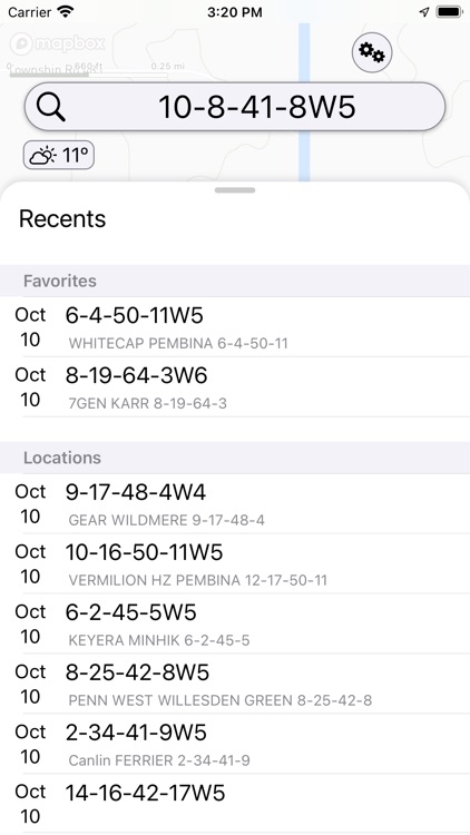
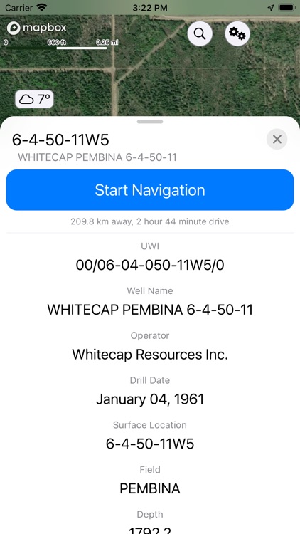
This multifunctional lease locator app makes getting to work in the oilfield a breeze. Simply enter the legal land description, name, or API number to view the surface location OR drop a pin on the map to view location and well info (if vertical). The location can be navigated to in-app, or opened in Apple or Google maps for turn by turn navigation. Change the origin location to see step-by-step directions to location from the nearest town, useful for putting together ERPs or providing visitors directions.
No cell service? No problem. As long as turn by turn navigation is started before service is lost, the directions will continue to function so you don't have to worry about being stranded halfway to location.
Enter a location and view well information such as the operating company, depth, drill date, current status, downhole fluid, formation, and more. Data varies depending on the region.
See the current, future AND past weather specific to the location entered. Wondering if the lease is too wet or has snow to be cleared? View the precipitation the location was forecasted to receive in the past three days. Scroll for 48 hrs of hourly forecasts, 7 daily forecasts, and previous forecasts.
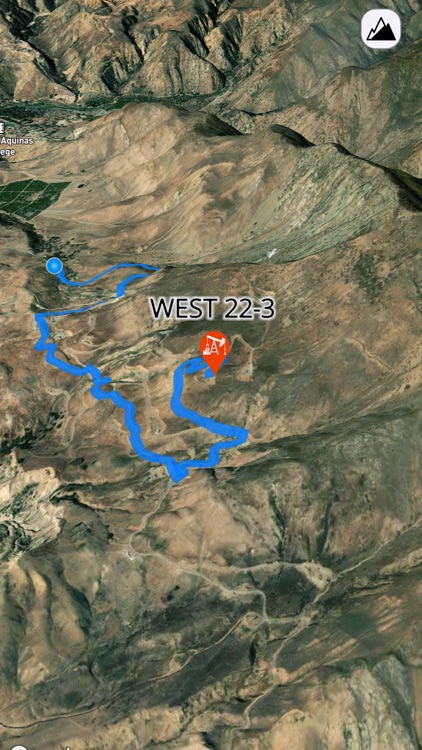
Drop a pin on the map to see the location and well info (if the well is vertical) for that location.
View history of past locations viewed and date they were looked up. Makes driving logs and reports a breeze by knowing where and when you were. iCloud support syncs history between compatible devices and creates a backup.
Maps can be shown in a variety of ways including Topographical, 3D Satellite, 2D Satellite, Dark Roads, and Light Roads.
-Turn by turn GPS navigation in-app, or use Apple or Google Maps
-Enter downhole location to view well info such as the operating company, depth, drill date, current status, -downhole fluid
-View the current weather at location as well as hourly and daily forecast AND previous forecasts to see if the location has received rain/snow is the past three days
-See location in app and view with standard, hybrid, or 3D satellite imagery
-Store history of previously viewed wells/locations
-Share location and well info via message
-Drop pins on the map to see that location's LSD and well info
-Internations support, find wells in the United States and Australia
*Google Maps app must be installed separately to open up locations with it
*Available well information varies by region
*Previous weather is based on previous forecasts, not what the location actually received
*The available options to look up locations varies by region
Disclaimer:
AppAdvice does not own this application and only provides images and links contained in the iTunes Search API, to help our users find the best apps to download. If you are the developer of this app and would like your information removed, please send a request to takedown@appadvice.com and your information will be removed.
AppAdvice does not own this application and only provides images and links contained in the iTunes Search API, to help our users find the best apps to download. If you are the developer of this app and would like your information removed, please send a request to takedown@appadvice.com and your information will be removed.