You are using an outdated browser. Please
upgrade your browser to improve your experience.
This application is designed for the geologist to use during field studies

Outcrop
by Next-Shot
What is it about?
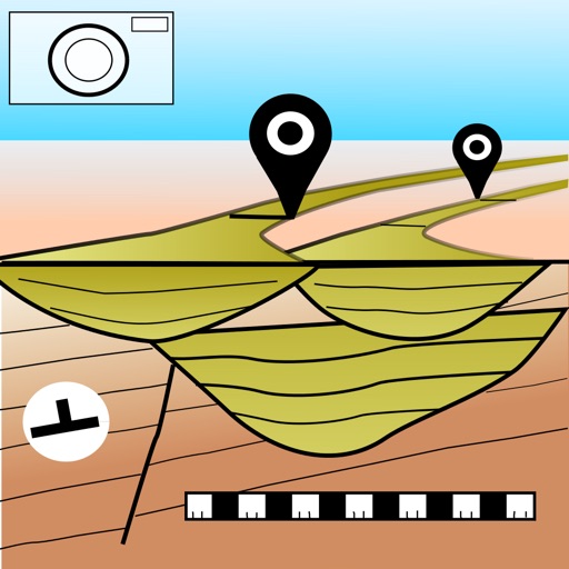
This application is designed for the geologist to use during field studies. It lets the user take pictures of the outcrop, interpret the high resolution image and export this information in 3D to construct a 3D geological model.
App Store Description
This application is designed for the geologist to use during field studies. It lets the user take pictures of the outcrop, interpret the high resolution image and export this information in 3D to construct a 3D geological model.
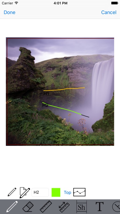
On the image, the user can interpret facies intervals, sedimentary structures and boundaries. The user can add annotations anywhere, measure width/height of sediment bodies (channels, lobes, etc.), and compute bodies statistics.
Using an iphone or ipad, the user can measure dip and azimuth and locate this measure on the picture or use its GPS location to export dip markers to the 3D model.
Once the user defines the image scale, all interpreted boundaries and intervals can be exported in 3D in GOCAD format (image, interpretations boundaries, dip/azimuth and facies intervals).
Disclaimer:
AppAdvice does not own this application and only provides images and links contained in the iTunes Search API, to help our users find the best apps to download. If you are the developer of this app and would like your information removed, please send a request to takedown@appadvice.com and your information will be removed.
AppAdvice does not own this application and only provides images and links contained in the iTunes Search API, to help our users find the best apps to download. If you are the developer of this app and would like your information removed, please send a request to takedown@appadvice.com and your information will be removed.