You are using an outdated browser. Please
upgrade your browser to improve your experience.

“Partition & Stakeout” is a handy app for iPad, iPhone and iPod touch that lets you precisely digitize a timber tract, a land parcel, a campus or any other real property and divide it into sub-areas

Partition & Stakeout
by CORVALLIS MICROTECHNOLOGY, INC.
What is it about?
“Partition & Stakeout” is a handy app for iPad, iPhone and iPod touch that lets you precisely digitize a timber tract, a land parcel, a campus or any other real property and divide it into sub-areas. If your device has GPS capability, you may record the GPS location as a Point, or pick the GPS location as a node for the Line or Area you are creating. You may also let the Stakeout functions in this app help you approach a point or move along a line or area boundary.
App Screenshots
App Store Description
“Partition & Stakeout” is a handy app for iPad, iPhone and iPod touch that lets you precisely digitize a timber tract, a land parcel, a campus or any other real property and divide it into sub-areas. If your device has GPS capability, you may record the GPS location as a Point, or pick the GPS location as a node for the Line or Area you are creating. You may also let the Stakeout functions in this app help you approach a point or move along a line or area boundary.
You can work with one or more jobs. The job data can be exported to DXF, and the coordinates and drawing can be output to PDF.
Detailed Function List:
* Precisely digitize Points, Lines and Areas over the built-in Map.
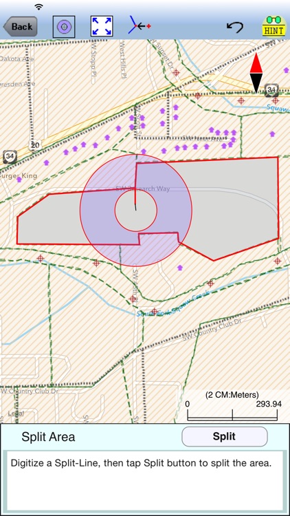
* Sub-divide an Area by Direction Cut, Hinge Cut or a digitized Split-Line.
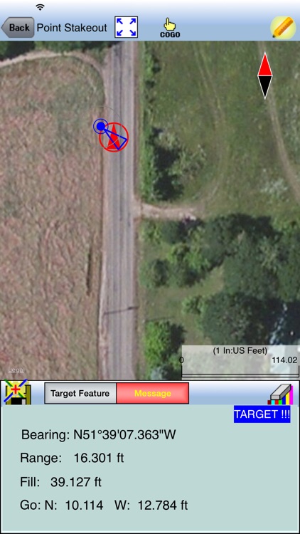
* Use Point Stakeout and GPS to locate a point or a node on a line.
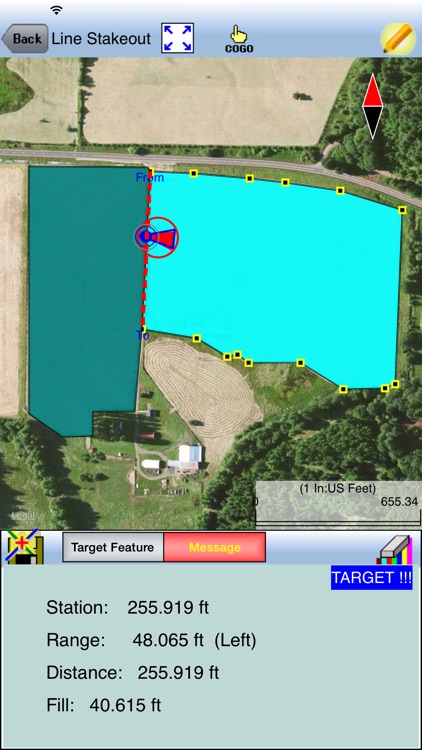
* Use Line Stakeout and GPS to locate a line.
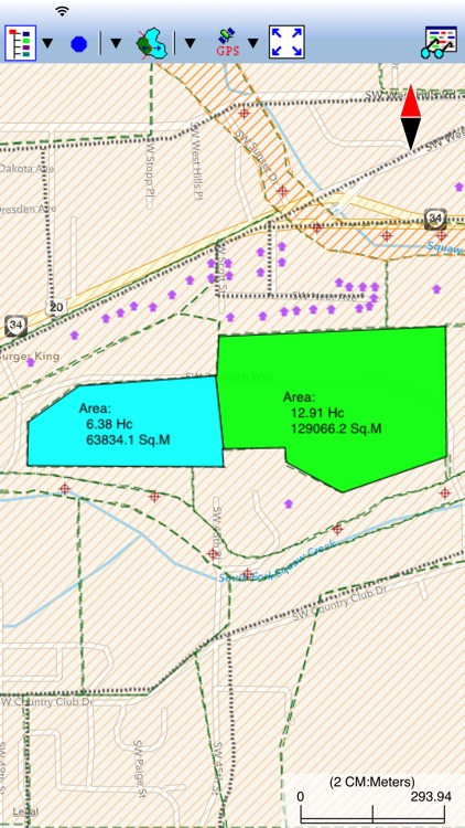
* View position, length and area values for the Features.
* Label the Lines with segment lengths and directions as well as corner angles.
* Label the Areas with size in acres and square feet or hectares and square meters.
* Measure distances and areas without saving the shapes.
* Move existing nodes to fine-tune the map drawing.
* Create a Point from entered coordinates.
* Create a Point or record a node by picking the GPS location.
* Save the job data file for later use.
* Export Feature data to DXF.
* Output the drawing and the coordinates to PDF.
* Email the job data files and the PDF files to your colleagues.
This app comes with a detailed built-in help document.
Please note: Location data depends on the GPS receiver used. Continued use of GPS running in the background can dramatically decrease battery life. The Partition & Stakeout app will let you easily toggle the built-in GPS on or off.
Disclaimer:
AppAdvice does not own this application and only provides images and links contained in the iTunes Search API, to help our users find the best apps to download. If you are the developer of this app and would like your information removed, please send a request to takedown@appadvice.com and your information will be removed.
AppAdvice does not own this application and only provides images and links contained in the iTunes Search API, to help our users find the best apps to download. If you are the developer of this app and would like your information removed, please send a request to takedown@appadvice.com and your information will be removed.