You are using an outdated browser. Please
upgrade your browser to improve your experience.

3D Sun, Moon and Night Photography Planning For Outdoor Photographers

Photographer's Ephemeris 3D
by Crookneck Consulting LLC

What is it about?
3D Sun, Moon and Night Photography Planning For Outdoor Photographers.
App Details
Version
1.4
Rating
(229)
Size
52Mb
Genre
Photo & Video Navigation
Last updated
September 20, 2019
Release date
June 19, 2017
More info
App Screenshots


App Store Description
3D Sun, Moon and Night Photography Planning For Outdoor Photographers.
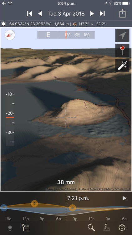
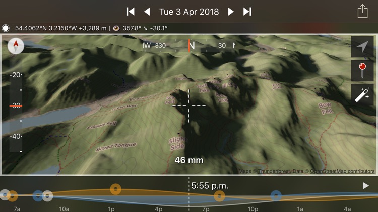
The Photographer's Ephemeris 3D (TPE 3D) is a unique natural light visualization tool for outdoor and landscape photographers shooting in varied terrain. It's a 3D map-centric Sun, Moon and Milky Way calculator: see how the light will fall on the land, day or night, for any location on earth.
"TPE3D predicted the light in the distance in the gap just before the right most hill very accurately." - OnLandscape Magazine
"This app has become an indispensable tool in my planning kit, I highly recommend it!" - David Kingham, Exploring Exposure
Watch a sunrise from the future in a rich simulation of sunlight, moonlight and starlight set against the actual topography of your planned shooting location.
Need to see when the arch of the Milky Way will rise between two mountain peaks? Need to see what time in the afternoon the valley will lose direct light in September?
Watch the light unfold under clear skies hours, days, weeks or years before you're actually there in person.
Key features includes:
- 3D topographic maps with simple navigation options
- Sun, moon and galactic centre continuous timeline showing key rise, set and transit events
- Full search capability to find your location (or enter decimal or DMS coordinates directly)
- Automated playback to watch a realtime or faster-than-realtime simulation of the light
- Flying mode for quick movement around a scene
- Enhanced mode for maximum topography and shadow detail
- Symbolic represetation of the Milky Way in Flying mode
- High resolution Milky Way and stars in Enhanced mode
- Direct elevation control for the 3D model camera
- Camera pitch and bearing indicators
- Moon phases are rendered accurately in the 3D scene
- Zoom in/out to equivalent 35mm focal length in enhanced mode
- Daily and annual events lists
- Shared location database with TPE
- Navigation and Artificial Highlights lighting modes
- Support for multiple map pins
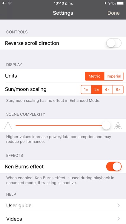
- User settings for controlling scene complexity
If you like to plan your natural light photography to capture the photo opportunities others miss, TPE 3D is a must-have tool!
Note:
- This app is CPU and graphics intensive: modern device models provide the best user experience and highest resolution data
- Not recommended for users who only shoot in flat terrain
- Satellite maps are not included
- Building are not shown in 3D
- Max elevation data resolution is 1 arcsecond (approximately 30m/33yards)
- Requires an internet connection
- Does not currently provide simulation of lighting during solar and lunar eclipses
- Topographic data is available only between 83°N and 83°S: data may contain artifacts and errors
- Availability of map types is subject to change, due to 3rd party map service availability, terms or conditions
Disclaimer:
AppAdvice does not own this application and only provides images and links contained in the iTunes Search API, to help our users find the best apps to download. If you are the developer of this app and would like your information removed, please send a request to takedown@appadvice.com and your information will be removed.
AppAdvice does not own this application and only provides images and links contained in the iTunes Search API, to help our users find the best apps to download. If you are the developer of this app and would like your information removed, please send a request to takedown@appadvice.com and your information will be removed.