You are using an outdated browser. Please
upgrade your browser to improve your experience.

Navigate, Track, explore, and gain insight with Pin-Point Maps

Pin-Point Maps
by Cole Wilhelmi

What is it about?
Navigate, Track, explore, and gain insight with Pin-Point Maps!
App Screenshots

App Store Description
Navigate, Track, explore, and gain insight with Pin-Point Maps!
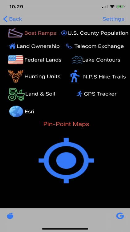
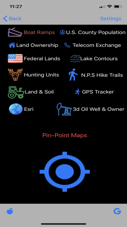
Hiking and camping: Use topo and satellite maps to measure distance, altitude, and location for hiking trails and campsites for all U.S. national parks.
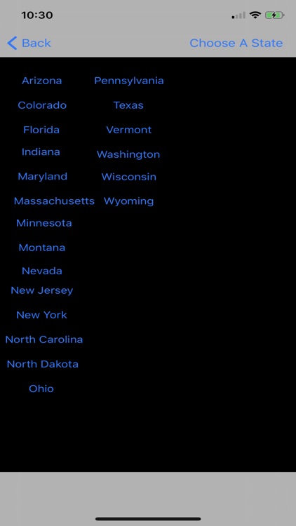
Hunting: Find state by state hunting units for all different species, public and private land access, and different animal ranges for the time of the year.
Federal Lands: gather data for all different federally owned land throughout the United States.
Land Ownership: gather insight on owned properties, from name of owner, property address, land and building value, and also offers google street view of property when available.
Farm and agriculture: offers state by state information on cropland data, soil surveys, farmland classes, crop production, bedrock depth, and erodibility factors.
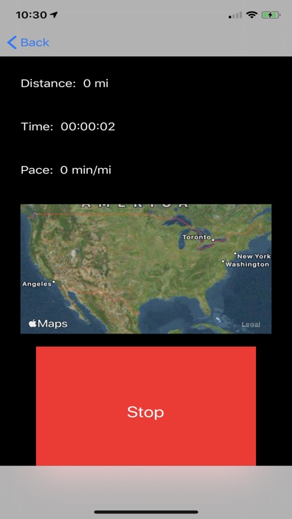
GPS Tracker: track your routes and distance and time of track.
Population estimates: gather data on county population estimates of all ages and ethical backgrounds.
Lake Contours: gather information of thousands of different lakes throughout the country of depths throughout the lake, average depth, max depth, and minimum depths.
Telecom Exchange: Find out owned regions of telecom companies offering services throughout the country.
Boat ramps: Gather insight on boat access for thousands of water bodies. Offering date installed, type of boat ramp, and directions to the boat ramp.
Main map service used is ESRI but also has Apple and google maps available for use, offering many different map views and uses.
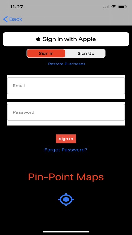
Subscription Management: User will be required to sign up for subscription after download but will be offered a free week trial. Subscriptions automatically renew unless cancelling 24 hours before the end of the trial, Your iTunes account will be charge otherwise. To cancel Subscription just active subscriptions in your iTunes account and cancel the subscription.
3d- 3d views offering land ownership and oil well data
App Support: https://pinpointmapssupport.wordpress.com
Privacy Policy: https://sites.google.com/view/pinpointmapsprivacy/home
Terms of Use: https://sites.google.com/view/pinpointmapstermsandconditions/home
Disclaimer:
AppAdvice does not own this application and only provides images and links contained in the iTunes Search API, to help our users find the best apps to download. If you are the developer of this app and would like your information removed, please send a request to takedown@appadvice.com and your information will be removed.
AppAdvice does not own this application and only provides images and links contained in the iTunes Search API, to help our users find the best apps to download. If you are the developer of this app and would like your information removed, please send a request to takedown@appadvice.com and your information will be removed.