You are using an outdated browser. Please
upgrade your browser to improve your experience.

With PIX4Dcatch, create 3D models and maps with your mobile device

PIX4Dcatch: 3D scanner
by Pix4D


What is it about?
With PIX4Dcatch, create 3D models and maps with your mobile device. Just point and capture to gather data, ready for accurate 3D model generation. Use it to recreate reality and measure the world around you.
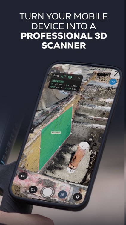
App Screenshots


App Store Description
With PIX4Dcatch, create 3D models and maps with your mobile device. Just point and capture to gather data, ready for accurate 3D model generation. Use it to recreate reality and measure the world around you.
You can pair it with a compatible RTK device to achieve centimeter-level accuracy for better 3D model precision and geolocation, and for performing single-point measurements.
To generate georeferenced 3D models, the collected images can be uploaded to PIX4Dcloud or exported to PIX4Dmatic. Both offer a 15-day trial to get started. Projects can also be freely exported, processed, and visualized in third-party photogrammetry software.
Workflow
1 - Scan: walk around your site. The app automatically gathers data and gives live feedback with iOS LiDAR, ensuring you capture every detail. For better accuracy, you can use either an RTK device compatible with PIX4Dcatch, our Pix4D targets with a fully automated workflow, or combine both for really accurate results.
2 - Upload or export: to process the data, upload it to PIX4Dcloud or export it to desktop software PIX4Dmatic. Get high-quality, accurate 2D and 3D outputs.
3 - Analyze and share: measure the space, share your results, and enjoy all the benefits of a detailed 3D model of your surroundings. Benefit from an immersive experience with augmented reality.
This workflow can be used for digitizing construction sites, measuring volumes (of stockpiles and other objects), keeping permanent records of underground utilities, and verifying your previously captured 3D models in AR in real time. Measure single points with confidence by using our compatible RTK devices. Digitize reality with your mobile phone.
Compatibility:
• Optimized for LiDAR-equipped devices
• All ARKit-enabled devices
• RTK devices: Pix4D adapted viDoc RTK, Emlid Reach RX, Trimble DA2
Usage information guidance:
Ensure the app is up to date.
Pix4D accepts no liability for damage, injuries, or legalities from the misuse of this app. Use only in safe environments.
Terms of Use:
https://www.apple.com/legal/internet-services/itunes/dev/stdeula/
Disclaimer:
AppAdvice does not own this application and only provides images and links contained in the iTunes Search API, to help our users find the best apps to download. If you are the developer of this app and would like your information removed, please send a request to takedown@appadvice.com and your information will be removed.
AppAdvice does not own this application and only provides images and links contained in the iTunes Search API, to help our users find the best apps to download. If you are the developer of this app and would like your information removed, please send a request to takedown@appadvice.com and your information will be removed.