You are using an outdated browser. Please
upgrade your browser to improve your experience.
Agrible’s Pocket Drone Control™ app easily connects to a user’s Agrible account to provide autonomous drone flights with immediate image processing

Pocket Drone Control™
by Agrible
What is it about?
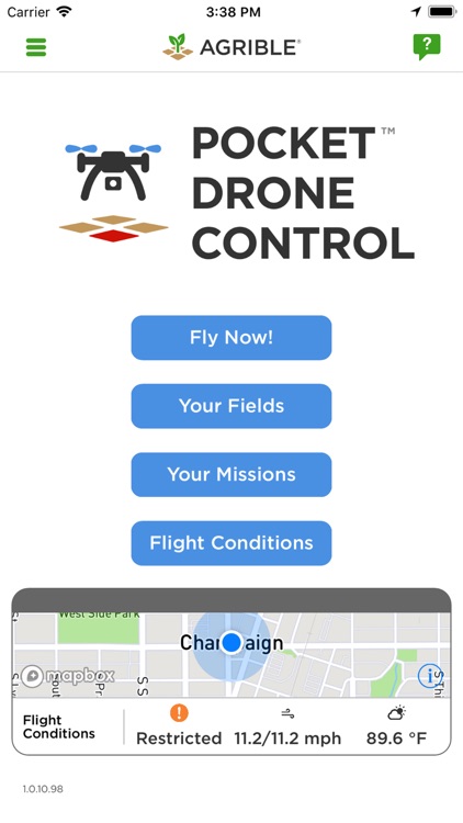
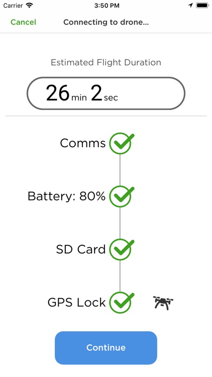
Agrible’s Pocket Drone Control™ app easily connects to a user’s Agrible account to provide autonomous drone flights with immediate image processing. Rapidly supplement traditional crop damage inspections and assessments with a bird's-eye view of the field and make decisions on the spot. Cover 80 acres in less than 25 minutes from drone launch to on-screen assessment.
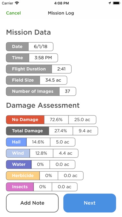
App Screenshots

App Store Description
Agrible’s Pocket Drone Control™ app easily connects to a user’s Agrible account to provide autonomous drone flights with immediate image processing. Rapidly supplement traditional crop damage inspections and assessments with a bird's-eye view of the field and make decisions on the spot. Cover 80 acres in less than 25 minutes from drone launch to on-screen assessment.
Your Fields
A flight plan is automatically created from the user's Agrible account or any shared accounts. Easily create a new field boundary on the fly by tapping on the field extremities.
Picture Pixel™ Grid
The Picture Pixel™ image grid provides a simple and accurate way to assess damage as soon as you land. Tap a Picture Pixel™ image to mark as damaged, or press and hold to view the full-resolution image and pinpoint damage in 0.1 acre increments.
Flight Conditions and More!
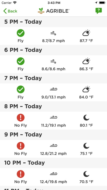
Get local weather and drone flight conditions for your current location and the locations of all your fields. Weather reports include wind speeds at the typical flight altitude, visibility, and no-fly zones.
Works with an upgraded Agrible account.
Disclaimer:
AppAdvice does not own this application and only provides images and links contained in the iTunes Search API, to help our users find the best apps to download. If you are the developer of this app and would like your information removed, please send a request to takedown@appadvice.com and your information will be removed.
AppAdvice does not own this application and only provides images and links contained in the iTunes Search API, to help our users find the best apps to download. If you are the developer of this app and would like your information removed, please send a request to takedown@appadvice.com and your information will be removed.