You are using an outdated browser. Please
upgrade your browser to improve your experience.

Proceq GPR Subsurface: Powerful sensors with radar beams for subsurface mapping applications

Proceq GPR Subsurface
by Screening Eagle Technologies

What is it about?
Proceq GPR Subsurface: Powerful sensors with radar beams for subsurface mapping applications. Intelligent software at your fingertips.
App Screenshots


App Store Description
Proceq GPR Subsurface: Powerful sensors with radar beams for subsurface mapping applications. Intelligent software at your fingertips.
The mission behind Proceq GPR Subsurface is simple: Scan the underground to provide a clear 3D image of what lies beneath, to detect and map the findings effortlessly and reliably, and to collaborate anywhere, anytime, for utility strike prevention, as-built map verification, structural investigations and various geophysical applications.
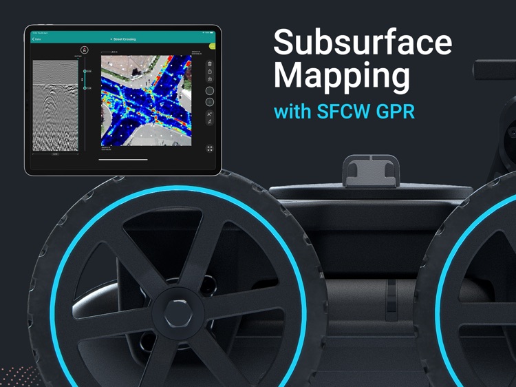
The revolutionary Proceq GS series is the world’s most advanced subsurface mapping system, equipped with Stepped-Frequency Continuous-Wave (SFCW) technology and precise GNSS positioning. The true-ultrawideband antenna system and Swiss-made, optimized electronics deliver unparalleled resolution and penetration depth - at the same time.
The magic starts once you connect the GS9000 or GS8000 wireless to your iPad and fire up the Proceq GPR Subsurface app. The carefully designed user interface increases your productivity by making measurements and analysis simple and intuitive; for example, by switching between top and sectional views with a simple gesture.
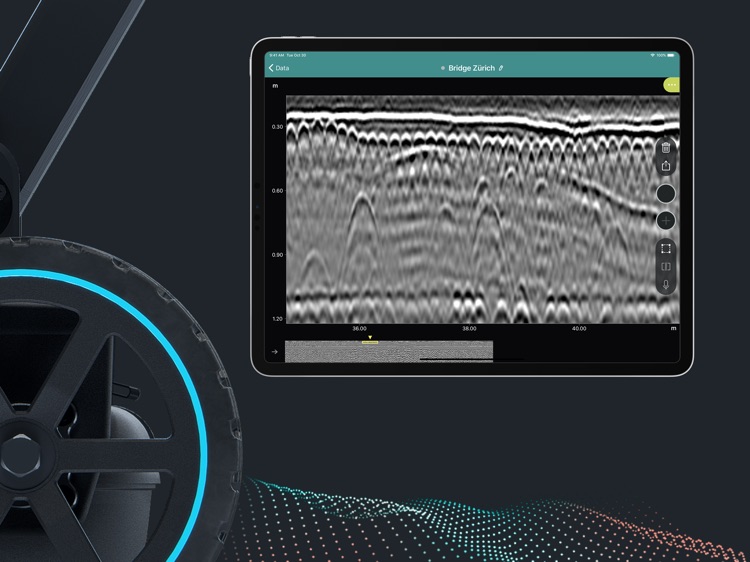
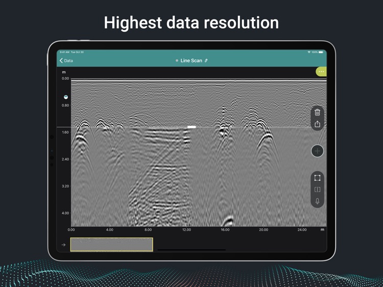
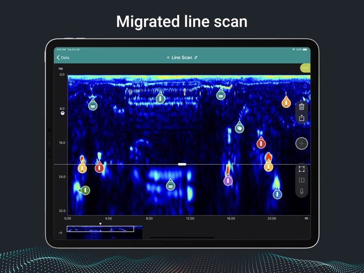
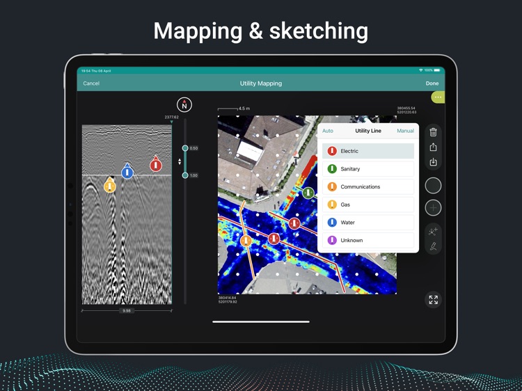
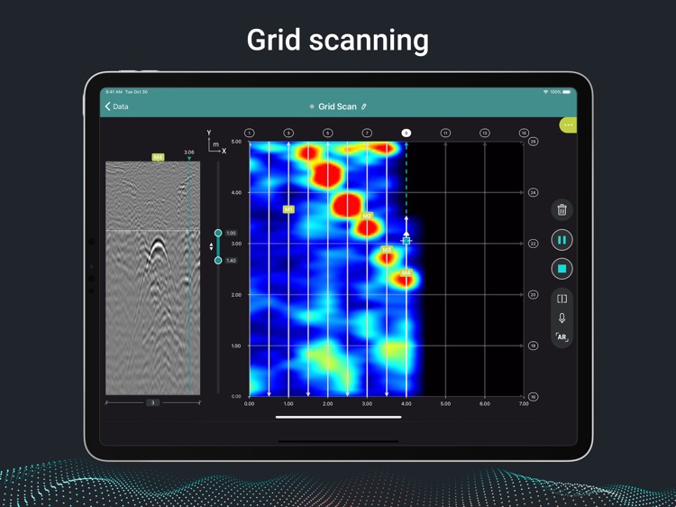
A rich feature set brings advanced workflows on-site, so that you can get more things done while in the field. See the heatmap of the subsurface form in front of your eyes at the specified depth range, annotate your findings with precise geolocation, tags, photos, voice memos and comments in the logbook. Access and share them with colleagues anywhere, anytime, and export your measurements in one click, in the form of rich reports, the most common CAD/GIS mapping formats, or raw data for further processing, all over the cloud.
Detect utility lines and label them accordingly to produce as-built maps, or digitize any other findings on the ground. Get an instant understanding of what is below your feet with the revolutionary Free Path 3D real-time visualization, or superimpose your area scans onto the real world with Augmented Reality - unique features in the industry.
Download the free app now and explore the state of the art of subsurface mapping with the included demo files.
Disclaimer:
AppAdvice does not own this application and only provides images and links contained in the iTunes Search API, to help our users find the best apps to download. If you are the developer of this app and would like your information removed, please send a request to takedown@appadvice.com and your information will be removed.
AppAdvice does not own this application and only provides images and links contained in the iTunes Search API, to help our users find the best apps to download. If you are the developer of this app and would like your information removed, please send a request to takedown@appadvice.com and your information will be removed.