You are using an outdated browser. Please
upgrade your browser to improve your experience.
Regional Geographic Information System of Novosibirsk region is designed to maintain general and industry-specific spatial data, to provide access to map of Novosibirsk region for public and local authorities, individuals and organizations, and to implement related business-processes for executive and local government bodies of Novosibirsk region

RGIS NSO
by CNGT NSO GBU NSO
What is it about?
Regional Geographic Information System of Novosibirsk region is designed to maintain general and industry-specific spatial data, to provide access to map of Novosibirsk region for public and local authorities, individuals and organizations, and to implement related business-processes for executive and local government bodies of Novosibirsk region.
App Screenshots
App Store Description
Regional Geographic Information System of Novosibirsk region is designed to maintain general and industry-specific spatial data, to provide access to map of Novosibirsk region for public and local authorities, individuals and organizations, and to implement related business-processes for executive and local government bodies of Novosibirsk region.
General features
- Handy tools for work with mobile map
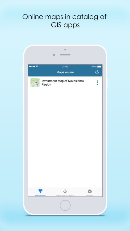
Take advantage of using your full functional mobile map - find your current location using GPS/GLONASS option, orientate yourself to terrain, turn map layers on and off, zoom in and out, identify objects, measure distances and areas, record your tracks on the way. Access interactive maps located in the portal of GIS apps or work with offline maps on your mobile device.
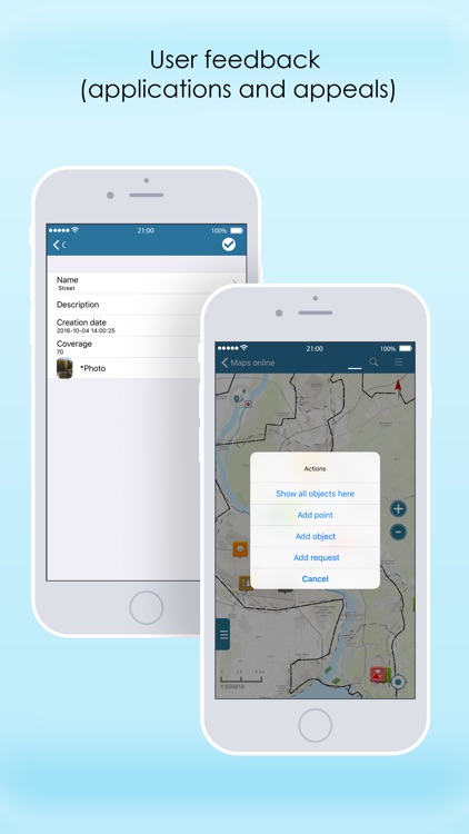
- User feedback
Add pushpins indicating points of illegal trash dumping sites, submit application to start industrial construction or to take part in the government support program directly on the investment map.
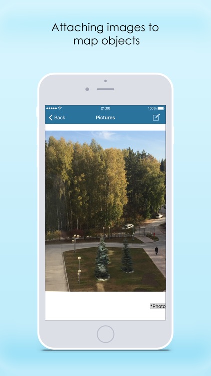
- Attaching media files to objects
Collected data can be described in more detail, just attach photos taken on-site by your mobile device or select appropriate ones from your gallery
- Easy-to-use
User friendly interface clear for any non-GIS-savvy users requires no professional skills and experience for work with mobile maps.
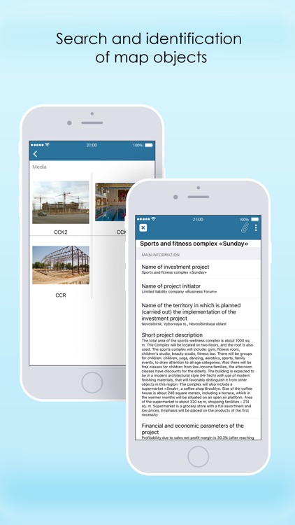
- Objects search and identification
Search objects on your map by keywords in attributes, learn information about objects from identification cards containing detailed description, attached photos, links to related external sources, etc.
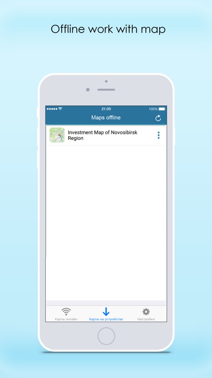
- Complete autonomy
Work with your maps in any remote locations or in private networks independent of internet availability and online-services. Note that RGIS NSO app is free and you will not need any paid accounts or subscriptions to use it.
Any questions or comments regarding use of RGIS NSO application can be addressed at rgis.service@nso.ru.
Continued use of GPS running in the background can dramatically decrease battery life.
Disclaimer:
AppAdvice does not own this application and only provides images and links contained in the iTunes Search API, to help our users find the best apps to download. If you are the developer of this app and would like your information removed, please send a request to takedown@appadvice.com and your information will be removed.
AppAdvice does not own this application and only provides images and links contained in the iTunes Search API, to help our users find the best apps to download. If you are the developer of this app and would like your information removed, please send a request to takedown@appadvice.com and your information will be removed.