You are using an outdated browser. Please
upgrade your browser to improve your experience.

Roam MTB is a revolutionary app for mountain bike trail navigation that uses real time 3D maps

Roam MTB | 3D mountain bike trail maps
by Roam Tech Pty Ltd


What is it about?
Roam MTB is a revolutionary app for mountain bike trail navigation that uses real time 3D maps. Roam MTB works without an internet connection or mobile phone signal.
Roam MTB | 3D mountain bike trail maps is FREE but there are more add-ons
-
$4.49
Roam MTB Credit
App Screenshots

App Store Description
Roam MTB is a revolutionary app for mountain bike trail navigation that uses real time 3D maps. Roam MTB works without an internet connection or mobile phone signal.
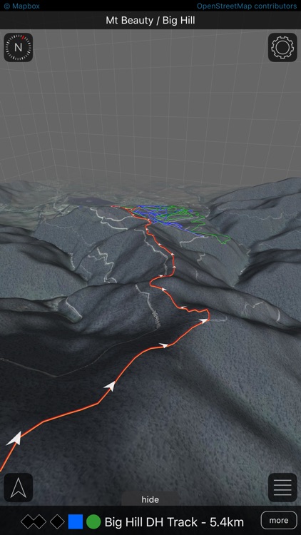
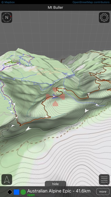
View your exact location on the innovative and interactive 3D maps. You can navigate your way through a mountain bike trail network and easily determine your location relative to nearby mountains, valleys and other mountain bike trails.
Each 3D map has a complete trail list with valuable information on each trail.
Tap on a trail to instantly get its name, length and difficulty rating.
Place waypoints on the map to mark where you’ve been and where you want to go.
It’s better than having a local guide showing you where all the good stuff is!!
APP FEATURES
- Innovative and interactive 3D trail maps for selected mountain bike parks and mountain bike events.
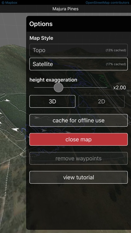
- Complete offline use.
- Place waypoints anywhere on any of the 3D trail maps.
- Regularly updated park and trail information.
- In app map store with free and paid maps.
- Adjustable height exaggeration to enhance mountainous terrain.
- Intuitive gestures for rotating and tilting the 3D map.
- Toggle between 2D and 3D mode.
- An easy to follow tutorial with animations.
- Trail data automatically updates as needed when an internet connection is available.
- Choose between satellite and Roam Topo map styles.
- 3D terrain rendered using topographic data generated from NASA’s Shuttle Radar Topography Mission.
Disclaimer:
AppAdvice does not own this application and only provides images and links contained in the iTunes Search API, to help our users find the best apps to download. If you are the developer of this app and would like your information removed, please send a request to takedown@appadvice.com and your information will be removed.
AppAdvice does not own this application and only provides images and links contained in the iTunes Search API, to help our users find the best apps to download. If you are the developer of this app and would like your information removed, please send a request to takedown@appadvice.com and your information will be removed.