You are using an outdated browser. Please
upgrade your browser to improve your experience.

As flexible as mapping on paper but with the benefits of a fully digital workflow

Rock Mapper
by Stefan Vollgger
What is it about?
As flexible as mapping on paper but with the benefits of a fully digital workflow. Record geotechnical information and generate georeferenced rock face maps, 3D LiDAR scans & sampling datasets for direct use in geological modelling, grade control and mine planning.
App Screenshots


App Store Description
As flexible as mapping on paper but with the benefits of a fully digital workflow. Record geotechnical information and generate georeferenced rock face maps, 3D LiDAR scans & sampling datasets for direct use in geological modelling, grade control and mine planning.
Rock Mapper is packed with powerful features:
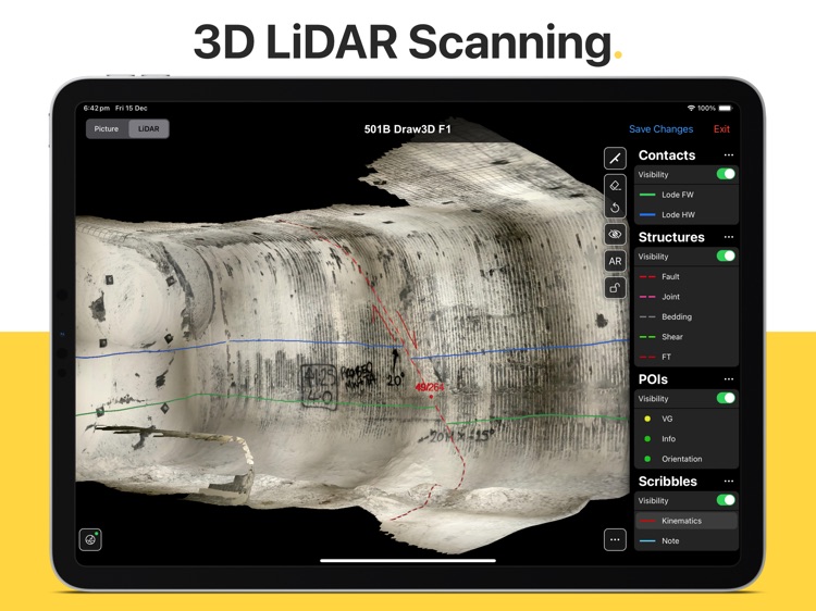
- 3D LIDAR SCANNING. Capture coloured point clouds of rock faces in less than 20 seconds.
- PHOTOGRAPHY. Take face photographs with the iPad's built-in camera.
- GEOREFERENCING. Register face photographs and LiDAR scans based on a single reference point.
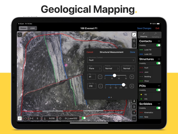
- MAPPING. Directly map onto face photographs using fully customisable mapping layers.
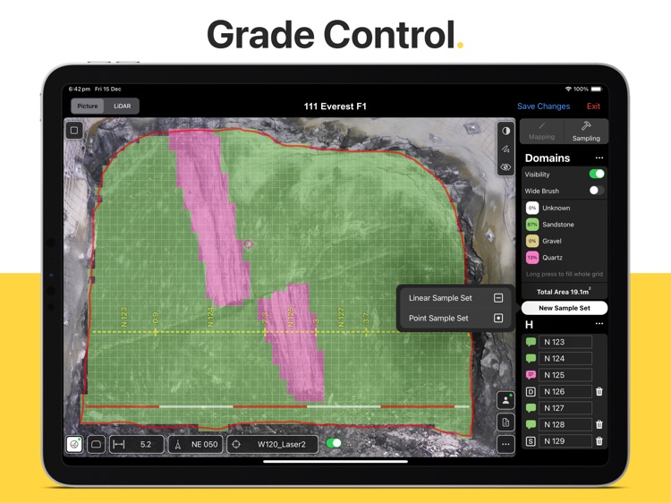
- SAMPLING. Record face samples by directly drawing onto the rock face photograph and seamlessly add QAQC data such as Duplicates, Blanks and Standards.
- Q SYSTEM. Dedicated tool for rock mass quality assessment (after NGI Handbook 2015 / Barton et al 1974)
- REPORTING*. Auto-generated mapping reports (including geotechnical info) & sampling reports (PDF format).
- CLOUD SYNC*. All data immediately available on your desktop computer and other connected devices in a fully georeferenced format.
*PRO feature (available with subscription)
Our clients love the ease of use, time savings and collaboration possibilities. Rock Mapper will lift your geological/geotechnical mapping quality and productivity to a whole new level.
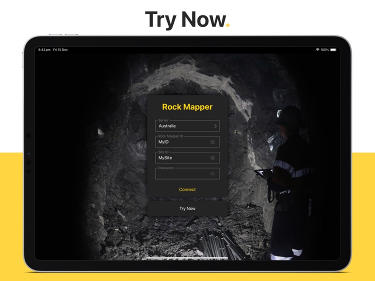
>>> Become a Rock Mapper today.
Disclaimer:
AppAdvice does not own this application and only provides images and links contained in the iTunes Search API, to help our users find the best apps to download. If you are the developer of this app and would like your information removed, please send a request to takedown@appadvice.com and your information will be removed.
AppAdvice does not own this application and only provides images and links contained in the iTunes Search API, to help our users find the best apps to download. If you are the developer of this app and would like your information removed, please send a request to takedown@appadvice.com and your information will be removed.