You are using an outdated browser. Please
upgrade your browser to improve your experience.

RTAB-Map (Real-Time Appearance-Based Mapping) is an Open Source LiDAR / RGB-D / Stereo Graph-Based SLAM approach based on an online incremental appearance-based loop closure detector

RTAB-Map - 3D LiDAR Scanner
by Mathieu Labbe
What is it about?
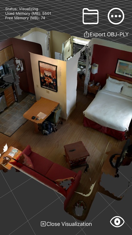
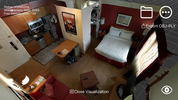
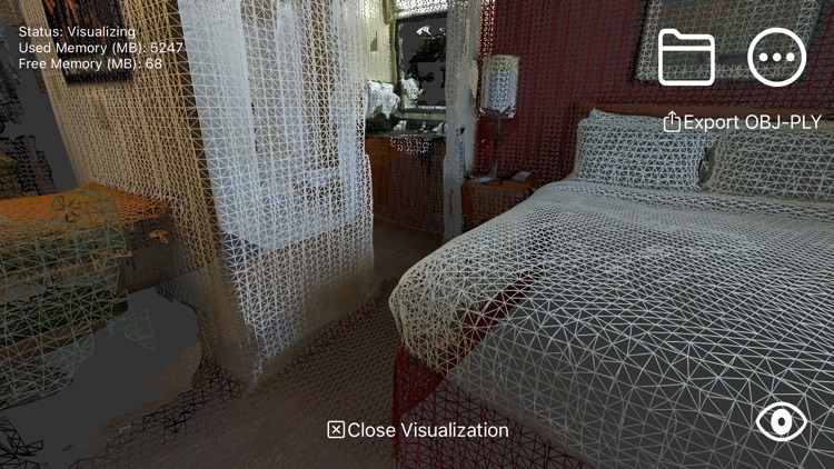
RTAB-Map (Real-Time Appearance-Based Mapping) is an Open Source LiDAR / RGB-D / Stereo Graph-Based SLAM approach based on an online incremental appearance-based loop closure detector. The loop closure detector uses a bag-of-words approach to determinate how likely a new image comes from a previous location or a new location. When a loop closure hypothesis is accepted, a new constraint is added to the map's graph, then a graph optimizer minimizes the errors in the map in real-time. An optional memory management approach can be used to limit the number of locations used for loop closure detection and graph optimization, so that real-time constraints on large-scale environnements are always respected.
App Store Description
RTAB-Map (Real-Time Appearance-Based Mapping) is an Open Source LiDAR / RGB-D / Stereo Graph-Based SLAM approach based on an online incremental appearance-based loop closure detector. The loop closure detector uses a bag-of-words approach to determinate how likely a new image comes from a previous location or a new location. When a loop closure hypothesis is accepted, a new constraint is added to the map's graph, then a graph optimizer minimizes the errors in the map in real-time. An optional memory management approach can be used to limit the number of locations used for loop closure detection and graph optimization, so that real-time constraints on large-scale environnements are always respected.
* Note that unlike other scanning apps that optimize the map after the mapping, with RTAB-Map you get loop closure detection and map optimization online so you can have feedback live to know when you have enough constraints in the map for good global optimization before stopping the scan.
*** 3D reconstruction available only with LiDAR sensor
Features:
* Online 3D scanning/mapping of the environment
* Online loop closure detection and map correction
* Save in DB format (RTAB-Map desktop and rtabmap_ros format)
* Export in PLY or OBJ
* Multi-session mapping (save and continue later)
* Use Apriltags to help find loop closures in textureless environments
* Mixed AR/VR First-Person in visualization mode
Disclaimer:
AppAdvice does not own this application and only provides images and links contained in the iTunes Search API, to help our users find the best apps to download. If you are the developer of this app and would like your information removed, please send a request to takedown@appadvice.com and your information will be removed.
AppAdvice does not own this application and only provides images and links contained in the iTunes Search API, to help our users find the best apps to download. If you are the developer of this app and would like your information removed, please send a request to takedown@appadvice.com and your information will be removed.