You are using an outdated browser. Please
upgrade your browser to improve your experience.
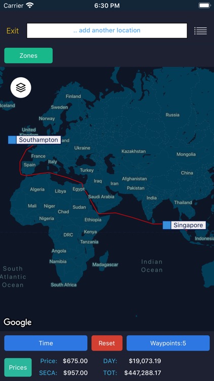
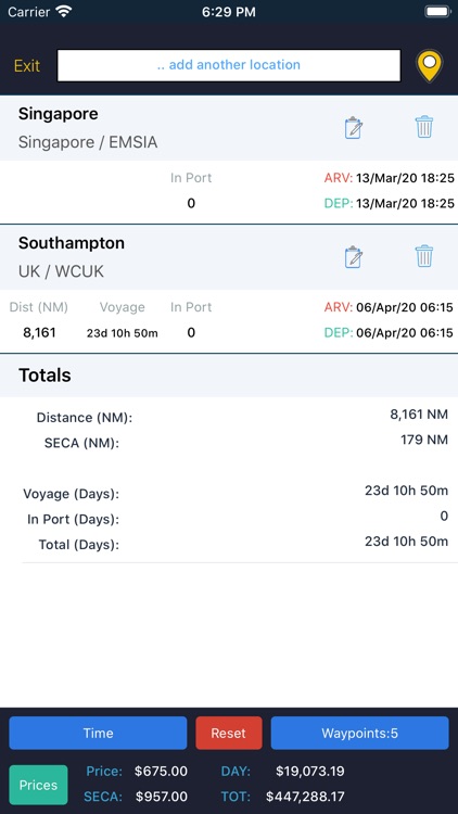
Sea/calc distance allows users to plot a route on a map and calculate the distance (including SECA distances) and voyage time between a number of waypoints, which can be locations, vessel AIS positions or points on a map

Sea/calc distance
by Maritech Services Limited
What is it about?
Sea/calc distance allows users to plot a route on a map and calculate the distance (including SECA distances) and voyage time between a number of waypoints, which can be locations, vessel AIS positions or points on a map.
App Store Description
Sea/calc distance allows users to plot a route on a map and calculate the distance (including SECA distances) and voyage time between a number of waypoints, which can be locations, vessel AIS positions or points on a map.
- View arrival and departures times in different formats, including the local time at each of the locations in your route
- Exclude certain waypoints to use a different routing option
View and select from a list of daily bunker prices
- Display vessel route in a timeline, showing where the vessel will be at any given time on the route
Disclaimer:
AppAdvice does not own this application and only provides images and links contained in the iTunes Search API, to help our users find the best apps to download. If you are the developer of this app and would like your information removed, please send a request to takedown@appadvice.com and your information will be removed.
AppAdvice does not own this application and only provides images and links contained in the iTunes Search API, to help our users find the best apps to download. If you are the developer of this app and would like your information removed, please send a request to takedown@appadvice.com and your information will be removed.