You are using an outdated browser. Please
upgrade your browser to improve your experience.

SkyLogger is a program for obtaining and storing flight data

SkyLogger
by Hartwig Wiesmann
SkyLogger Offers Apple Watch App
Check the details on WatchAware
Check the details on WatchAware
What is it about?
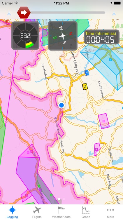
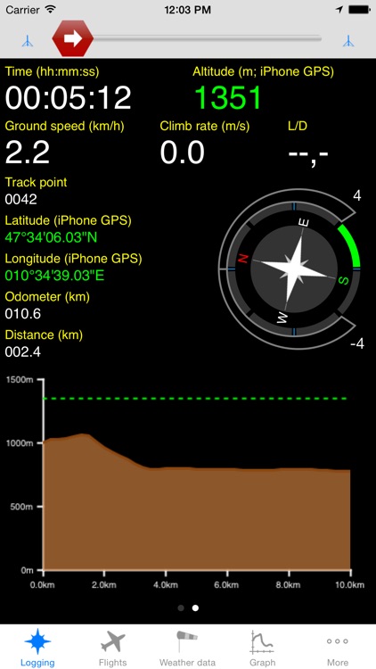
SkyLogger is a program for obtaining and storing flight data. The program is especially adapted for the usage by glider, hangglider and paraglider pilots. SkyLogger obtains the geodetic positions of the pilot during the flight and stores the data. Furthermore, the pilot is able to see during the flight the elapsed time, the distance to the take-off as well as the current ground speed and climb rate. A compass rose is indicating the current flight direction.
SkyLogger is $5.99 but there are more add-ons
-
$2.99
Live Tracking
-
$4.99
Airspaces
-
$0.99
Track traces
-
$2.99
Accelerometer
-
$1.99
Climb rate traces
-
$11.99
Maps from 3rd parties
-
$9.99
FlyNet accessory
-
$9.99
XC Tracer accessory
-
$1.99
Masqott
App Screenshots
App Store Description
SkyLogger is a program for obtaining and storing flight data. The program is especially adapted for the usage by glider, hangglider and paraglider pilots.
SkyLogger obtains the geodetic positions of the pilot during the flight and stores the data. Furthermore, the pilot is able to see during the flight the elapsed time, the distance to the take-off as well as the current ground speed and climb rate. A compass rose is indicating the current flight direction.
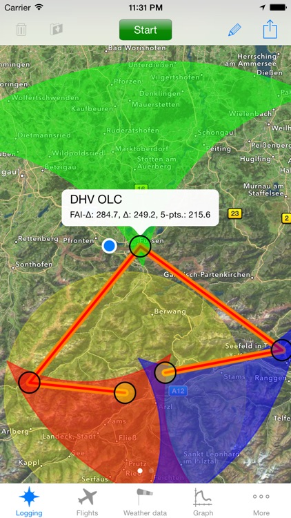
For competitions the pilot's and the aircraft's name, the aircraft's ID and the to be flown route can be entered.
During the flight the direction and distance to the next waypoint are shown on the display.
After finishing the flight the stored geodetic data together with the data for the competition can be converted into the common IGC file format. Additionally, also other popular formats like GPX and KML are supported. The created files are stored on the iPhone or can be sent to servers or other computers.
SkyLogger supports besides others the following features:
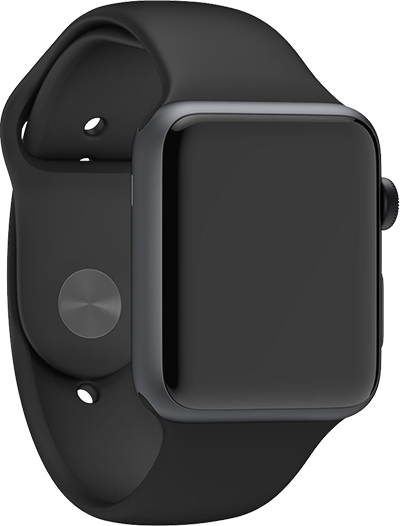
- control by Apple Watch;
- main data visualization on Apple Watch;
- cockpit / instrument view;
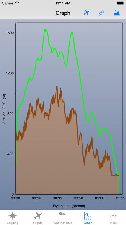
- 2D & 3D flight data visualization;
- downloadable map data;
- large and individually adaptable instruments on a moving map allow best viewing comfort;
- north or in flight direction orientation of moving map;
- live tracking support for Leonardo or Vgps servers
- visualization of previously flown flights as track traces on moving map;
- visualization of airspaces with user defined colors;
- instrument showing the distance and direction to the closest airspace;
- 3 axis acceleration measurements;
- tracked flights are stored in highly efficient internal database;
- default flight parameters can be stored and retrieved to make flight information entering for competitions easier;
- SkyLoggerXXL supports common file formats like IGC, CSV, GPX and KML;
- IGC files created by SkyLoggerXXL are OLC conform and can directly be sent to Leonardo, XCCup, XContest and XC globe based OLC servers;
- calculation of XC points for FAI triangle, triangle and free distance over 5 points;
- XC analysis (determination of FAI triangle areas);
- printing of flightbooks, flight information and statistics
- all diagrams, maps or charts can either be e-mailed or copied for incorporation into other apps;
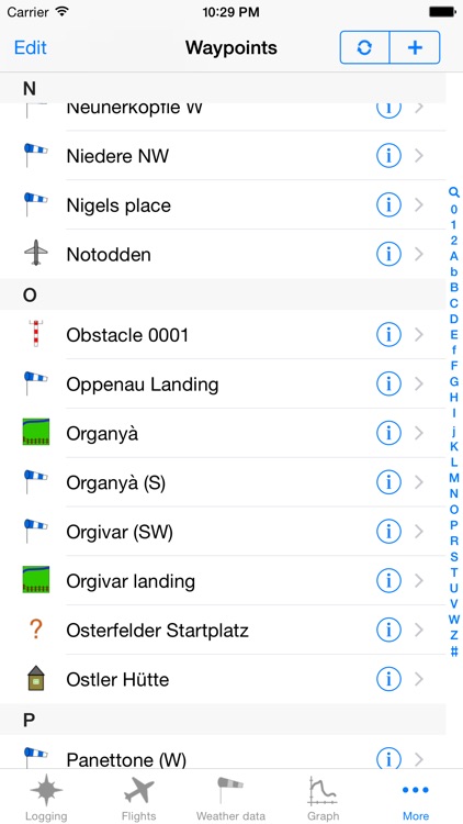
- integration of SkyView database for exchanging waypoints;
- support of FlyNet accessories;
- support of SensBox;
- weather data history of selected weather stations for the last 48 hours;
- online wind speed and direction visualization on maps for selected weather stations;
- visualization of hotspots;
- visualization of regions with thermals;
- visualization of climb rate traces;
- and much much more!
Warning: Continued use of GPS running in the background can dramatically decrease battery life.
Disclaimer:
AppAdvice does not own this application and only provides images and links contained in the iTunes Search API, to help our users find the best apps to download. If you are the developer of this app and would like your information removed, please send a request to takedown@appadvice.com and your information will be removed.
AppAdvice does not own this application and only provides images and links contained in the iTunes Search API, to help our users find the best apps to download. If you are the developer of this app and would like your information removed, please send a request to takedown@appadvice.com and your information will be removed.