You are using an outdated browser. Please
upgrade your browser to improve your experience.

3D Terrain Mapping and Hardscape Leveling System

Smart Leveler
by Mike East
What is it about?
3D Terrain Mapping and Hardscape Leveling System.
App Store Description
3D Terrain Mapping and Hardscape Leveling System.
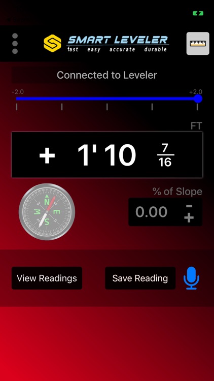
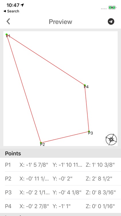
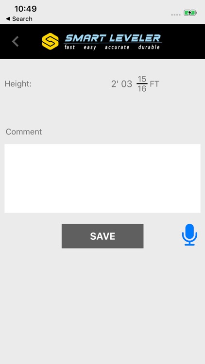
The only Precision Construction Altimeter on the market that allows you to plot or survey true 3D X,Y, and Z measurements then save, email, or upload directly into CAD. The ultimate instrument for bidding jobs. Figures % of Slope, Engineering Scale- Feet above sea level, includes photos with data, and compass.
Designed for the true professional specifically for the Hardscape Industry by Hardscape Pros!
Disclaimer:
AppAdvice does not own this application and only provides images and links contained in the iTunes Search API, to help our users find the best apps to download. If you are the developer of this app and would like your information removed, please send a request to takedown@appadvice.com and your information will be removed.
AppAdvice does not own this application and only provides images and links contained in the iTunes Search API, to help our users find the best apps to download. If you are the developer of this app and would like your information removed, please send a request to takedown@appadvice.com and your information will be removed.