You are using an outdated browser. Please
upgrade your browser to improve your experience.
The Smart Sea Level Sensors project is deploying a high density network of network-enabled water level sensors on the Georgia coast

Smart Sea Level Sensors
by Georgia Tech
What is it about?
The Smart Sea Level Sensors project is deploying a high density network of network-enabled water level sensors on the Georgia coast. The current deployment is centered around Savannah and Chatham County.
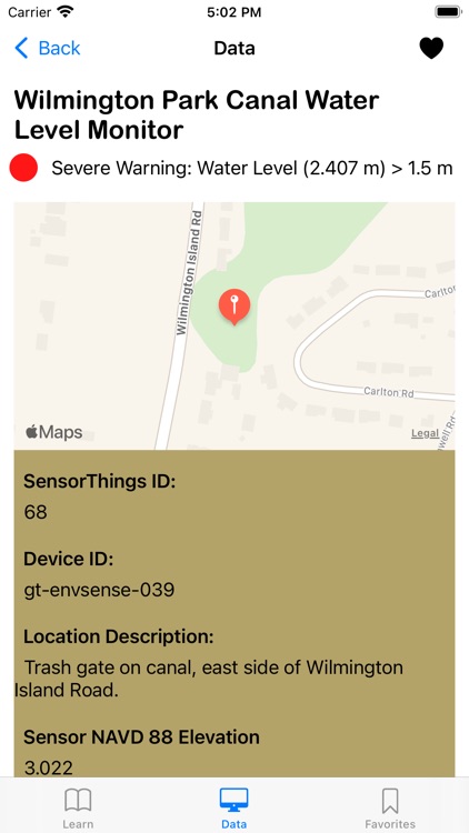
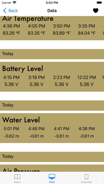
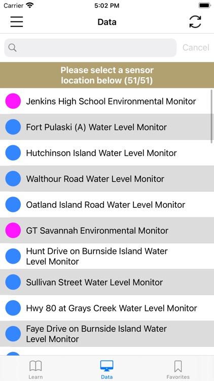
App Screenshots
App Store Description
The Smart Sea Level Sensors project is deploying a high density network of network-enabled water level sensors on the Georgia coast. The current deployment is centered around Savannah and Chatham County.
The project is a partnership between Chatham Emergency Management Agency officials, City of Savannah officials, and Georgia Tech scientists and engineers.
This application is specifically designed with you in mind. This app was created to allow the general public, government officials, and business owners across Chatham County to learn more about the project and easily access the information provided by the sensor network.
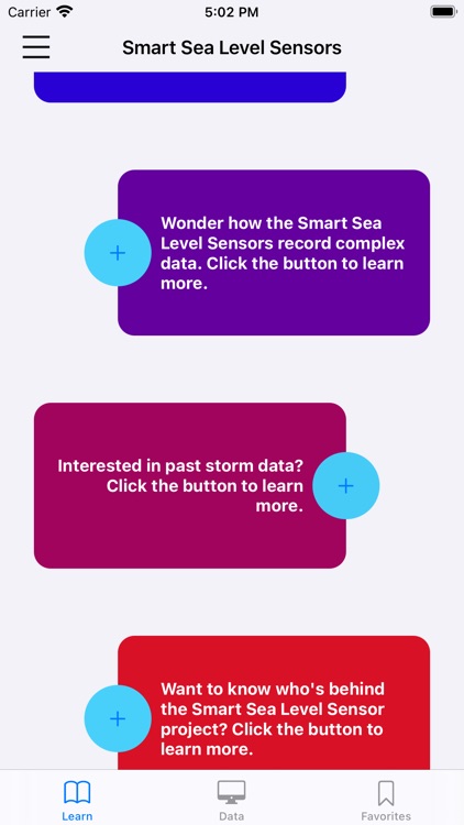
Learning Tab
- Learn about the mission statement and the purpose of this project
- Discover the significance of this project, especially regarding impacts of sea level rise
- Wonder how the sea sensors record data? Learn through the learning tab!
- Uncover past storm data and see how hurricanes impacted Chatham County
- Learn about the contributors and organizations developing this project
Data Tab
- Access sea level data from more than 50 sensors
- View water level, air temperature, air pressure, and battery level collected by each sensor
- Easily view each sensor's water level status at a glance
- View 50 of the most recent observations collected by each sensor
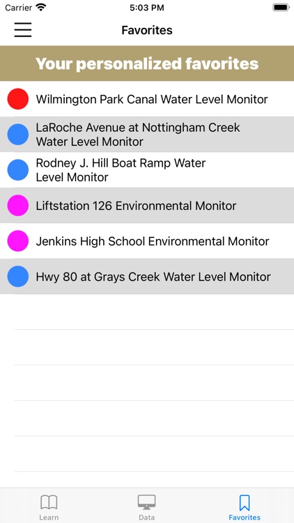
Favorites Tab
- Heart your favorite sensors to view them at a moment's notice
- Quick access to your most commonly viewed sensors
- Gain the flexibility to monitor a particular sensor location's water level
Through this app, you'll have the freedom to view water levels throughout Chatham County and plan your next visit.
Understand the sea level variations your home, work, or commute for daily use to track flooding or during hurricane season when water rise can cause property or vehicle damages.
Download the official Smart Sea Level Sensors app now and view sea level data throughout Chatham County!
Disclaimer:
AppAdvice does not own this application and only provides images and links contained in the iTunes Search API, to help our users find the best apps to download. If you are the developer of this app and would like your information removed, please send a request to takedown@appadvice.com and your information will be removed.
AppAdvice does not own this application and only provides images and links contained in the iTunes Search API, to help our users find the best apps to download. If you are the developer of this app and would like your information removed, please send a request to takedown@appadvice.com and your information will be removed.