You are using an outdated browser. Please
upgrade your browser to improve your experience.
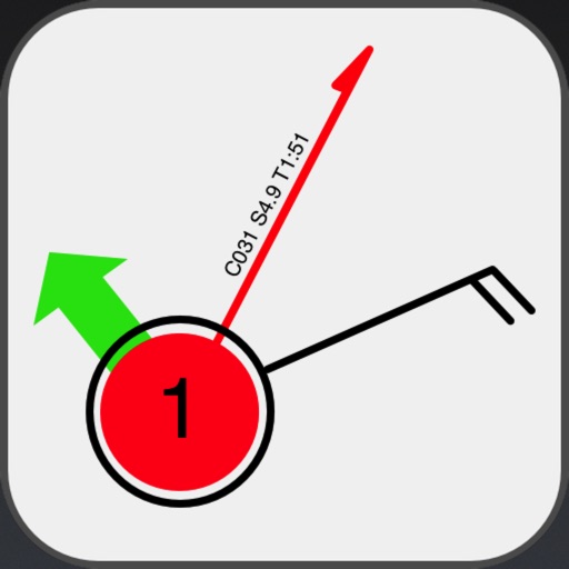
Tack Pack is an iPad passage planning tool for sailors

Tack Pad
by Rudder Nut LLC
What is it about?
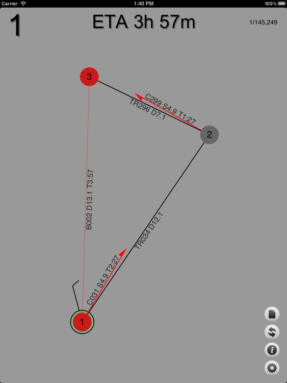
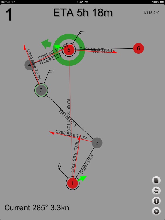
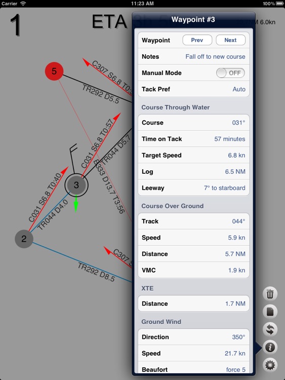
Tack Pack is an iPad passage planning tool for sailors. It computes tacking solutions for up or down wind destinations under selected wind and current conditions. Tack Pad uses Polars to estimate speed and leeway and will provide estimated time of arrival as well as detailed information about the course and tacks.
App Screenshots
App Store Description
Tack Pack is an iPad passage planning tool for sailors. It computes tacking solutions for up or down wind destinations under selected wind and current conditions. Tack Pad uses Polars to estimate speed and leeway and will provide estimated time of arrival as well as detailed information about the course and tacks.
Tack Pad is not a chart plotter or GPS navigation app, but a tool to use in conjunction with a navigation app or with paper charts.
Tack Pad supports multiple waypoints, entered as bearing and distance along with wind and current, and computes course to steer, speed over ground, time on tack (ETA to tack points), overall ETA, VMG along waypoint bearings, as well as cross track error from tack points to waypoint bearing lines. The app will produce downwind solutions as well, including downwind gybes.
The interface is interactive, simply drag wind barbs, current arrows, tack points and waypoints to explore the options available to you. Solutions are computed as you drag items around, so it’s very easy to rapidly explore multiple scenarios.
Wind speed and direction as well as current set and drift can be modified on each waypoint or tack point to produce a complete multi-waypoint solution. This allows you to explore solutions involving changing weather and to explore course options and possibilities.
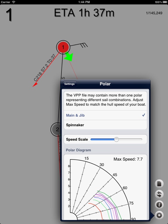
Speed and leeway estimates are computed from three included polar files which can be scaled to fit your boat characteristics, or you can load your own for more accuracy. Waypoints can also be put into a manual mode which allows you to specifically set leeway and speed over ground values. This is useful for situations where the computed values don’t match reality, or you simply want to motor on that leg of the trip, or are forced to motor due to wind or current.
Disclaimer:
AppAdvice does not own this application and only provides images and links contained in the iTunes Search API, to help our users find the best apps to download. If you are the developer of this app and would like your information removed, please send a request to takedown@appadvice.com and your information will be removed.
AppAdvice does not own this application and only provides images and links contained in the iTunes Search API, to help our users find the best apps to download. If you are the developer of this app and would like your information removed, please send a request to takedown@appadvice.com and your information will be removed.