You are using an outdated browser. Please
upgrade your browser to improve your experience.

Tactical Navigator (“TacNav”) is a mobile application tool for communications, operations, and outdoor planning--perfect for any military or outdoor enthusiast

Tactical Navigator
by Orange Clover LLC
What is it about?
Tactical Navigator (“TacNav”) is a mobile application tool for communications, operations, and outdoor planning--perfect for any military or outdoor enthusiast! Whether you want to save a training location or your best fishing spot, this app is for you.
App Screenshots

App Store Description
Tactical Navigator (“TacNav”) is a mobile application tool for communications, operations, and outdoor planning--perfect for any military or outdoor enthusiast! Whether you want to save a training location or your best fishing spot, this app is for you.
Tactical Navigator comes with the following features:
Basic App Features
• Compass
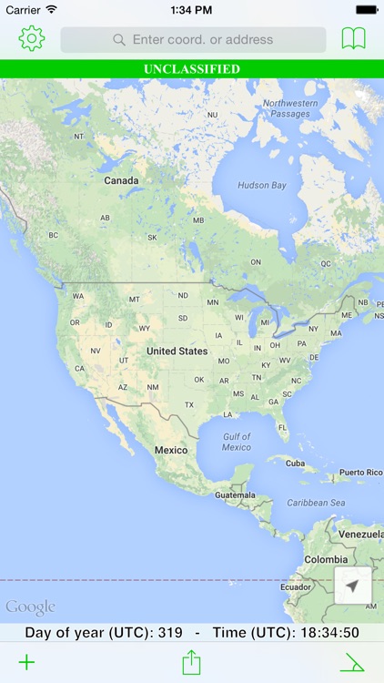
• Day of Year & UTC Time always visible
• Add many locations to the map at the same time
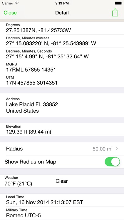
• Coordinate systems: Degrees, DM.m, DMS, MGRS, and UTM
• Search by address or any coordinate format
• Elevation
• Current weather conditions and temperature
• Local and Military time
• Choice of Metric or Imperial measurement values
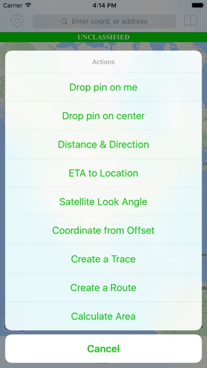
Enhanced Map Actions
• Distance & Direction
• ETA to a location
• Calculate a Satellite Look Angle
• Calculate an offset coordinate given distance & direction
• Trace a path
• Routes (great for land navigation)
• Calculate Area
• Add a radius around a location
Other Great Features
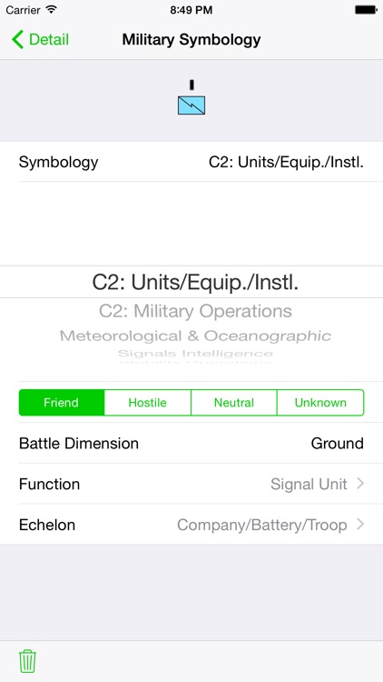
• Use MIL-STD-2525C symbology to change your location's icon
• Save notes to your saved locations
• Open Turn-by-Turn apps for driving directions with 3rd party apps (Apple Maps, Google Maps™, and Waze)
• Universal application for use on iPhone or iPad
• iCloud integration to sync across your devices and auto-backup your data
• Angle of Device (ex. to assist positioning a ground satellite)
• Share your data with other TacNav users via encrypted AirDrop™ or email
• Export your data to KML
Thank you for your support and using TacNav.
US Army LTC Kevin Militello - Owner & Developer
Disclaimers:
• Continued use of GPS running in the background can dramatically decrease battery life
• TacNav is not endorsed by any government agency
Disclaimer:
AppAdvice does not own this application and only provides images and links contained in the iTunes Search API, to help our users find the best apps to download. If you are the developer of this app and would like your information removed, please send a request to takedown@appadvice.com and your information will be removed.
AppAdvice does not own this application and only provides images and links contained in the iTunes Search API, to help our users find the best apps to download. If you are the developer of this app and would like your information removed, please send a request to takedown@appadvice.com and your information will be removed.