You are using an outdated browser. Please
upgrade your browser to improve your experience.

Tom Harrison Maps has produced high-quality California hiking trail maps for a number of years now

Tom Harrison: Mammoth High Country
by International Mapping
What is it about?
Tom Harrison Maps has produced high-quality California hiking trail maps for a number of years now. To reach a new wave of technologically savvy outdoor enthusiasts, Tom Harrison Maps teamed up with International Mapping to adapt their trail map series for the iPhone and iPad. International Mapping has surrounded their maps with a variety of easy-to-use navigational tools and personal customization features to help make your outdoor experience more enjoyable and memorable.
App Screenshots
App Store Description
Tom Harrison Maps has produced high-quality California hiking trail maps for a number of years now. To reach a new wave of technologically savvy outdoor enthusiasts, Tom Harrison Maps teamed up with International Mapping to adapt their trail map series for the iPhone and iPad. International Mapping has surrounded their maps with a variety of easy-to-use navigational tools and personal customization features to help make your outdoor experience more enjoyable and memorable.
California’s Mammoth High Country is one of the most popular getaway and outdoor recreation areas in the United States. Planning a hike in the Mammoth High Country? Looking for an app to help you navigate all of the trails? Worried you will not have Wi-Fi access while out on the trail? Then this is the app for you as we have included everything you will need in the download!
Key Content Features:
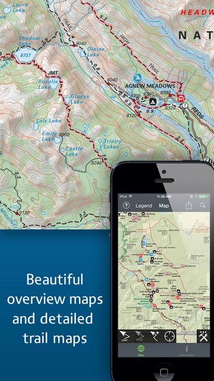
+ Full content and detail from Tom Harrison’s Mammoth High Country map covering Minarets, June Lake, Ritter Range, Convict Lake, Mono Craters, Devils Postpiles, Mammoth Lakes, Agnew Meadows, and Thousand Island Lake.
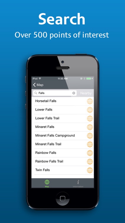
+ Point of Interest listings for over 500 locations in and around the Mammoth High Country Area
Key Features Include:
+ GPS tracking of your location, even without Wi-Fi or cell reception
+ A revolutionary new trail navigation system
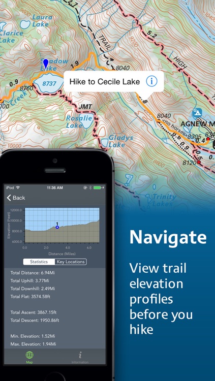
+ Detailed, offline terrain profiling and statistics for any trail you create
+ Map tools including distance, bearing and compass
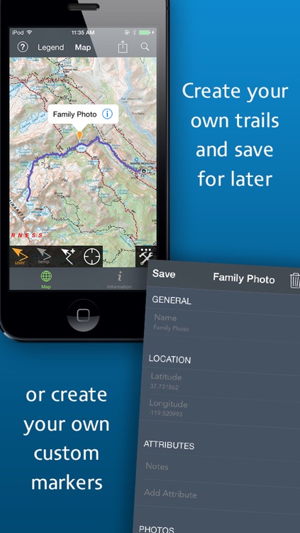
+ Customized pins to record photos, comments, & Locations along your hike
+ Share your custom markers with others who have the app
+ Customize your markers to change their appearance
+ Detailed search capabilities by nearby locations and by type
+ Identify the Latitude/Longitude for any place on the map
Tom Harrison: Mammoth High Country was developed by International Mapping. To learn more visit: www.internationalmapping.com
Disclaimer:
AppAdvice does not own this application and only provides images and links contained in the iTunes Search API, to help our users find the best apps to download. If you are the developer of this app and would like your information removed, please send a request to takedown@appadvice.com and your information will be removed.
AppAdvice does not own this application and only provides images and links contained in the iTunes Search API, to help our users find the best apps to download. If you are the developer of this app and would like your information removed, please send a request to takedown@appadvice.com and your information will be removed.