You are using an outdated browser. Please
upgrade your browser to improve your experience.
Planning to travel within Canada for your next wilderness adventure

TopoPoint Canada
by Ebranta Technologies Inc
What is it about?
Planning to travel within Canada for your next wilderness adventure? Don't leave home without the proper map application for your iPhone!
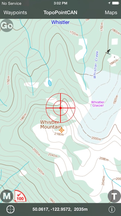
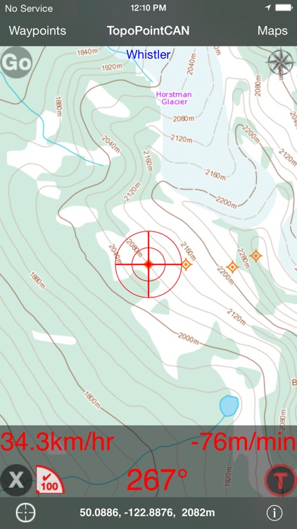
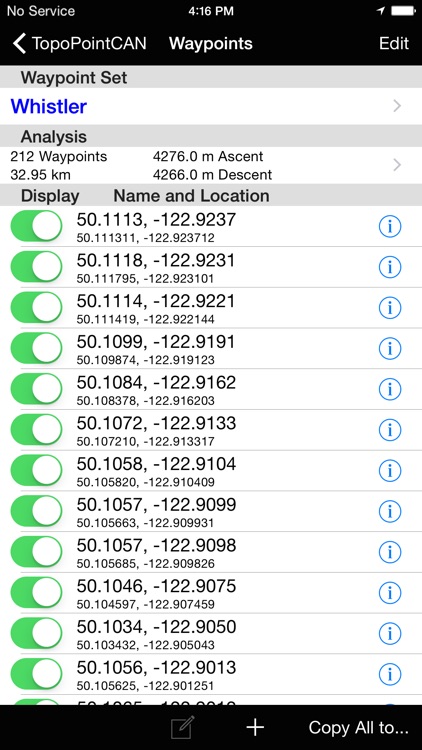
App Screenshots
App Store Description
Planning to travel within Canada for your next wilderness adventure? Don't leave home without the proper map application for your iPhone!
Introducing TopoPoint Canada, a wilderness navigation tool for displaying FREE Natural Resources Canada (NRCan) high resolution topographic map images and your GPS position whether you are online or not!
NRCan topographic maps contain the highest detail of any map suitable for wilderness travel within Canada. TopopointCAN downloads these maps from an NRCan server and stores them on your iPhone.
◆◆Updated for iOS 10.
◆◆"Pinch and Zoom" now supported!
◆◆TopoPointCAN v2.12 delivers essential features in a lightweight (3.3MB) package:
◆GPS course and speeds displayed on an optional overlay popup by pressing the 'M' button. How fast can you ski?
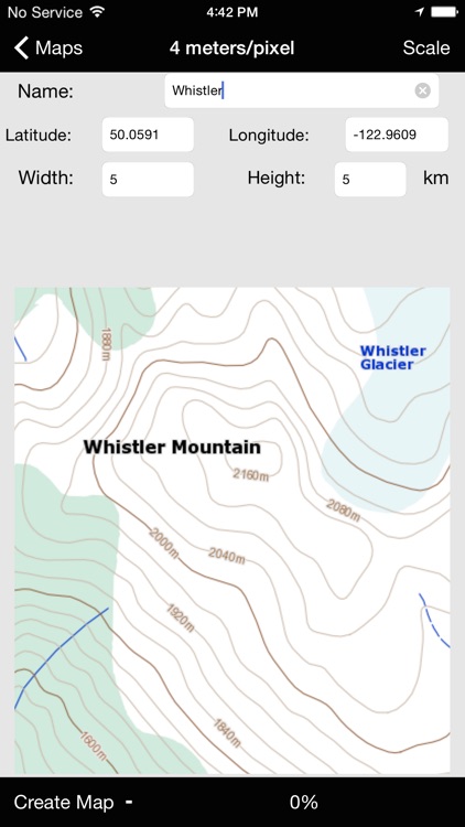
◆Multiple map scale support: 2, 4, 8, 16, and 64 meters per pixel.
◆Compass feature displays true or magnetic north!
◆Online "browse to location" feature displays arial and street map data when downloading maps or browsing to a location.
◆Robust scrolling main map view that moves seamlessly across entire UTM zones.
As your GPS position changes the map will automatically track in the direction you are traveling. "Swipe" scrolling away from your current location invokes browse mode. Pressing the 'locate' button resumes tracking of your current GPS position. Coordinates are displayed in decimal degrees format.
◆No Service? No Problem!
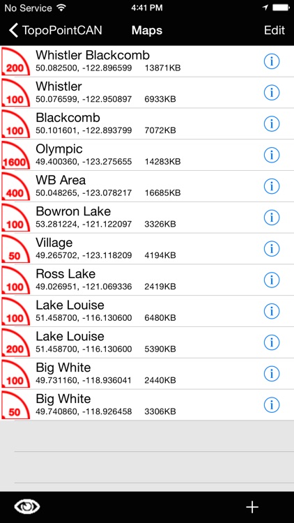
Simply download maps of your choice directly to TopoPointCAN's Map Case before departing the cellular data service area or WiFi connection. Your maps will be available anywhere! The map name is chosen by the user and displayed on the main screen when in use. To browse a saved map in the main screen, just select it in the map list and return to the main TopoPointCAN screen.
◆TopoPointCAN gives the user control over downloaded map sizes and boundaries.
By specifying downloaded map location and size, the user has control over how much data will be stored. After downloading, maps can be browsed in the main screen to ensure the correct data is onboard.
◆Automatic offline or online operation
When located within a cellular data service area or connected to WiFi, TopoPointCAN will automatically download and display map images for your current or browse location. When offline, TopoPointCAN will automatically display stored maps in the main screen. When in locate mode, the GPS position indicator will automatically display your position on offline saved maps in the main screen.
◆Main screen display of GPS Position with accuracy and map scale information.
TopoPointCAN features an innovative GPS position indicator with integrated radial map scale and GPS accuracy information. Scale and GPS altitude can be displayed in English or Metric units.
◆Powerful Browsing capabilities with position display.
TopoPointCAN also includes advanced browsing capabilities. Detailed Latitude and Longitude coordinates are displayed when browsing map images away from your current location. A precise browse position indicator with map scale is also displayed when browsing.
◆Fully featured Waypoint capabilities, including "Tracks" ('T' button).
TopoPointCAN creates Waypoints with a single main screen button press. Current GPS location or browse location is recorded by simply tapping the coordinate display text button in the bottom toolbar. Waypoints can also be entered manually. UTM coordinate and creation time are also recorded for each Waypoint. GPS altitude is recorded for Waypoints created with GPS position. Waypoints are stored in user definable Waypoint Sets and can be emailed via the iPhone's mail application.
◆◆More features are coming soon!
Please Note:
GPS features require an iPhone with GPS capabilities.
Continued use of GPS running in the background can dramatically decrease battery life.
The map images displayed are only available for locations within Canada.
Disclaimer:
AppAdvice does not own this application and only provides images and links contained in the iTunes Search API, to help our users find the best apps to download. If you are the developer of this app and would like your information removed, please send a request to takedown@appadvice.com and your information will be removed.
AppAdvice does not own this application and only provides images and links contained in the iTunes Search API, to help our users find the best apps to download. If you are the developer of this app and would like your information removed, please send a request to takedown@appadvice.com and your information will be removed.