You are using an outdated browser. Please
upgrade your browser to improve your experience.
Travel Midwest is the official mobile app of the popular travelmidwest

Travel Midwest
by University of Illinois

What is it about?
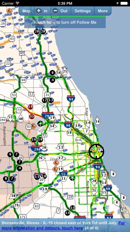
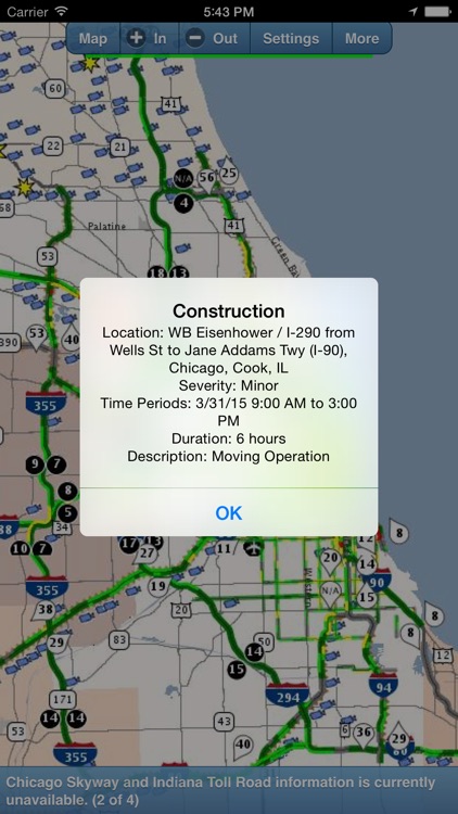
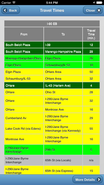
Travel Midwest is the official mobile app of the popular travelmidwest.com travel website. It provides a traffic map for the Chicago, Milwaukee, Madison and Rockford metropolitan areas, the Quad Cities, northwest Indiana, and southwestern Michigan. Map layers include Travel Times, Expressway Congestion, Arterial Congestion, Expressway Construction, Arterial Construction, Incidents, Weather, and Cameras. Select from preset maps, center the map on your current position, or have the app track your position in real-time as you travel using the "Follow Me" feature. Move and zoom the map anywhere in the coverage area, tap on the map to get details about incidents, travel times, construction, or to view camera images. View various notices and reports from different geographic areas. Optionally participate in the Connected Vehicles initiative by allowing the app to transmit your location to help us better compute congestion and travel times. An indispensable app for commuters and all regional travelers.
App Screenshots
App Store Description
Travel Midwest is the official mobile app of the popular travelmidwest.com travel website. It provides a traffic map for the Chicago, Milwaukee, Madison and Rockford metropolitan areas, the Quad Cities, northwest Indiana, and southwestern Michigan. Map layers include Travel Times, Expressway Congestion, Arterial Congestion, Expressway Construction, Arterial Construction, Incidents, Weather, and Cameras. Select from preset maps, center the map on your current position, or have the app track your position in real-time as you travel using the "Follow Me" feature. Move and zoom the map anywhere in the coverage area, tap on the map to get details about incidents, travel times, construction, or to view camera images. View various notices and reports from different geographic areas. Optionally participate in the Connected Vehicles initiative by allowing the app to transmit your location to help us better compute congestion and travel times. An indispensable app for commuters and all regional travelers.
Disclaimer:
AppAdvice does not own this application and only provides images and links contained in the iTunes Search API, to help our users find the best apps to download. If you are the developer of this app and would like your information removed, please send a request to takedown@appadvice.com and your information will be removed.
AppAdvice does not own this application and only provides images and links contained in the iTunes Search API, to help our users find the best apps to download. If you are the developer of this app and would like your information removed, please send a request to takedown@appadvice.com and your information will be removed.