You are using an outdated browser. Please
upgrade your browser to improve your experience.

When you need timely traffic information, you have to go to the source

Tripmate France Lite
by Emanuele Cipolloni
What is it about?
When you need timely traffic information, you have to go to the source.
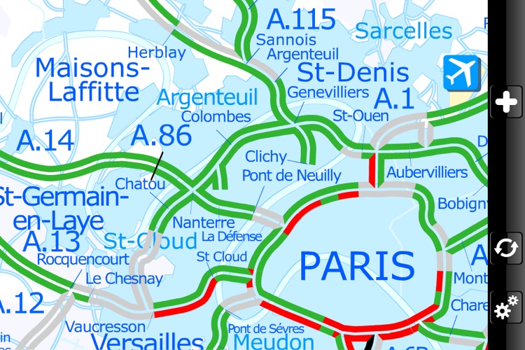
App Screenshots
App Store Description
When you need timely traffic information, you have to go to the source.
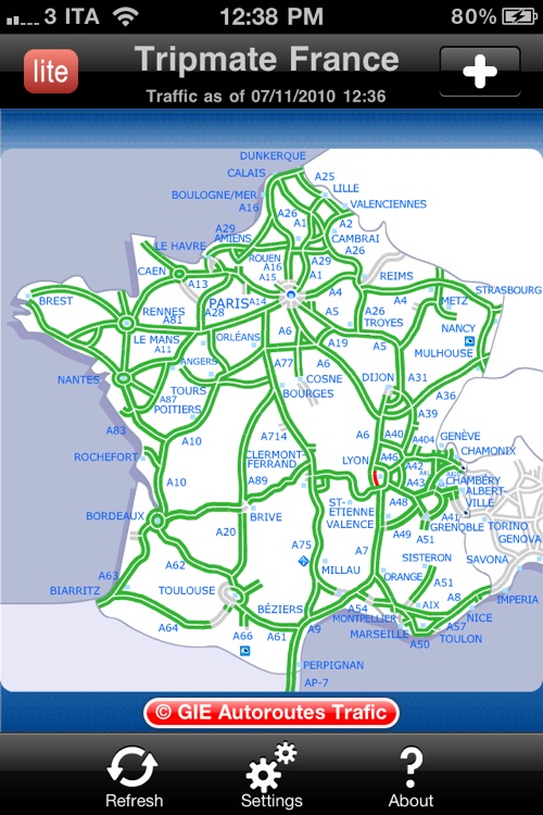
In France, the source is the Autoroutes Trafic web site: detailed and highly readable maps, intuitive symbolism and traffic status updated in real-time.
Unfortunately the Autoroutes Trafic web site uses a technology that makes it unusable on your iPhone, iPod Touch or iPad.
Tripmate France, thanks to its real-time transcoding technology, makes it possible to visualize the portion of Autoroutes Trafic web site concerning the traffic status; it also offers a number of options and parameters to personalize the fruition of the service.
Main features:
- Application completely optimized to facilitate map searching, browsing while on the road without distracting
- Universal application: works on iPhone, iPod Touch and iPad making full use of the hosting device user interface paradigm
- Full use of Retina Display to visualize more details in high resolution (only on iPhone 4)
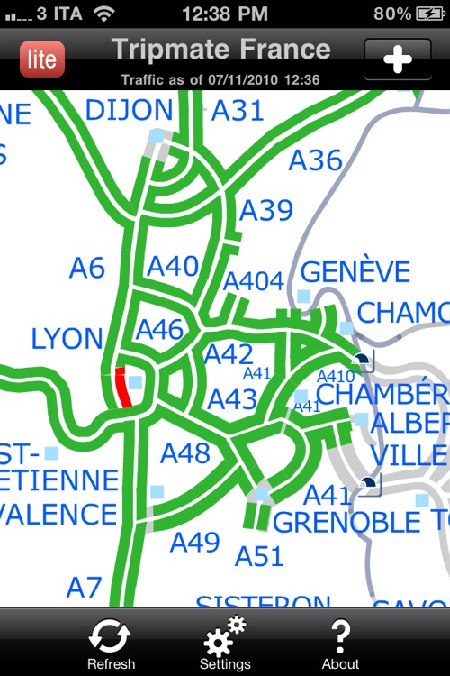
- National map and Paris Île-de-France; An additional set of 68 detailed maps, covering the whole French motorway network, is available in the full version of Tripmate France
- Maps are automatically cached and only updated traffic status and information are downloaded: faster operation and minimal data download
- Visual research of locations and maps
- High contrast colored maps to quickly pinpoint problems on the road. Option to reduce colors brightness (night vision)
- Touch based map moving and zooming
- Ten levels of zoom. All maps are completely vector, when zooming: more details, no blocky pixels
- All maps selected and positioning are automatically cached to allow for fast retrieval of previous selections without searching again
- Status of traffic shown using color codes: free flow, heavy, congested and closed. The segments representing the congested and closed conditions can optionally flash on the screen to enhance the visibility of problems
- Visible/Audible alarms to notify about changed (compared to the previous data update) traffic status and/or information over the currently selected map
- Manual or automatic refresh (with selectable refresh interval)
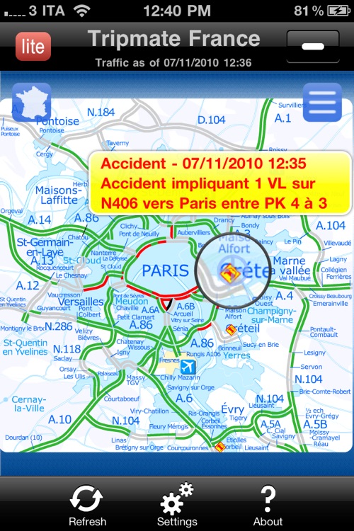
- Road problems/information are shown using icons (accidents, queues, road works, closures). Tapping an icon shows the complete information about the problem
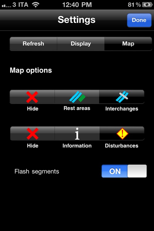
- Level of information shown on the map selectable (Disturbances, Information, Infrastructures)
- Interface available in three languages: French, English and Italian
- Online help always available to quickly explain the meaning of each control and symbols shown by the application
Disclaimer:
AppAdvice does not own this application and only provides images and links contained in the iTunes Search API, to help our users find the best apps to download. If you are the developer of this app and would like your information removed, please send a request to takedown@appadvice.com and your information will be removed.
AppAdvice does not own this application and only provides images and links contained in the iTunes Search API, to help our users find the best apps to download. If you are the developer of this app and would like your information removed, please send a request to takedown@appadvice.com and your information will be removed.