You are using an outdated browser. Please
upgrade your browser to improve your experience.
Vectorial Map allows you to view Mapsforge (OpenStreetMap) offline vector maps and record GPS tracks in the background

Vectorial Map Lite
by Harald Meyer

What is it about?
Vectorial Map allows you to view Mapsforge (OpenStreetMap) offline vector maps and record GPS tracks in the background. It supports different map styles, basic track editing and route planning, and online maps.
Vectorial Map Lite is FREE but there are more add-ons
-
$3.99
Enable tracking and remove ads
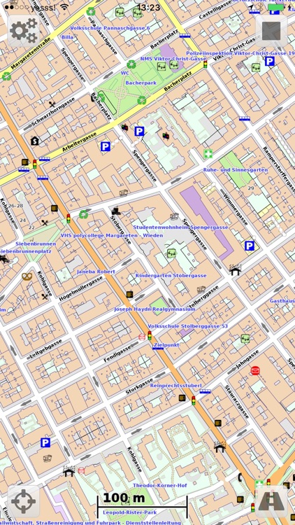
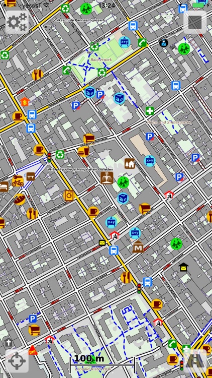
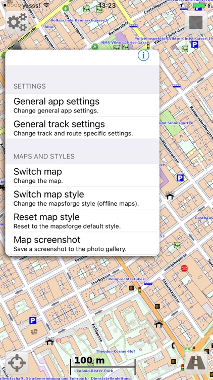
App Screenshots
App Store Description
Vectorial Map allows you to view Mapsforge (OpenStreetMap) offline vector maps and record GPS tracks in the background. It supports different map styles, basic track editing and route planning, and online maps.
Features:
- View Mapsforge offline vector maps (.map).
- Change the map's look and feel on the fly using custom Mapsforge XML style sheets.
-* Record GPS tracks in the background.
- Support for slippy format online tile sources (such as OpenStreetMap.org, OpenCycleMaps, Mapquest Aerial/Satellit).
-* Import and edit tracks and waypoints (GPX, KML, KMZ).
-* Draw your own tracks and waypoints (e.g. for trip planning).
-* Calculate routes along up to 50 anchors points (requires internet connection).
- Search for POIs (requires internet connection).
- Capture map screenshots.
- Maps, styles, and track files can be imported using iTunes file sharing and with the iOS "Open in" feature (e.g. using Dropbox, Safari, etc.).
-* Open recorded tracks with other apps using "Open in" feature.
- Support for OSMAnd/Locus offline raster maps (*.sqlitedb).
- Download maps (free) and styles directly in Vectorial Map.
* The features marked with "*" can be enabled with a single one-time in-app-purchase.
More information: http://www.vectorialmap.com/
Vectorial Map Help and Support: http://www.vectorialmap.com/ioshelp
### Manage tracks and waypoints on a Mac/PC ###
The desktop version of Vectorial Map available on the Vectorial Map website (http://www.vectorialmap.com/download) includes a database manager which can be used to easily export, import, and view tracks and waypoints which were recorded with the mobile version of Vectorial Map. More information: http://www.vectorialmap.com/mobiledbmanager
### Contact ###
Please contact us using the contact form if you have questions, feedback, or bug reports: http://www.vectorialmap.com/contact
### Mapsforge ###
Mapsforge is a popular offline vector map format which provides small, but high quality maps which can be easily adapted to custom needs using style sheets.
DISCLAIMER
Vectorial Map uses continuous GPS during tracking. Continued use of GPS running in the background can dramatically decrease battery life.
Disclaimer:
AppAdvice does not own this application and only provides images and links contained in the iTunes Search API, to help our users find the best apps to download. If you are the developer of this app and would like your information removed, please send a request to takedown@appadvice.com and your information will be removed.
AppAdvice does not own this application and only provides images and links contained in the iTunes Search API, to help our users find the best apps to download. If you are the developer of this app and would like your information removed, please send a request to takedown@appadvice.com and your information will be removed.