You are using an outdated browser. Please
upgrade your browser to improve your experience.

VFRInfo provides all informations about your VFR flight destination at your fingertips

VFRInfo
by frobese GmbH


VFRInfo Offers Apple Watch App
Check the details on WatchAware
Check the details on WatchAware
What is it about?
VFRInfo provides all informations about your VFR flight destination at your fingertips.
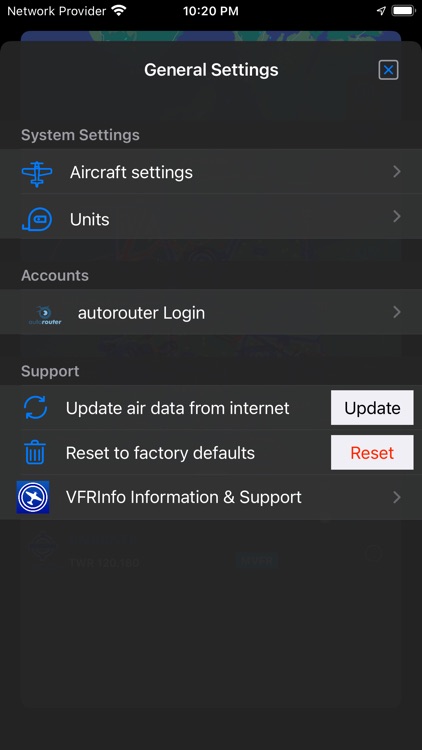
App Screenshots


App Store Description
VFRInfo provides all informations about your VFR flight destination at your fingertips.
Garmin Pilot or Foreflight are too expensive and clumsy for planning VFR flights in the surrounded neighborhoods.I looked for something small and easy to use without additional costs or fees. There was nothing satisfactory for my, so I started to develop these app on my personal needs. Now I'm an IFR pilot but for a quick weather or NOTAM information I still use and love my app especially the widgets and the iWatch app are very useful for a first glance.
To assist your flight planing VFRInfo assist you with all runway, radio, METAR and TAF informations of the airfields. Within your existing autorouter account (provided by autorouter web site) VFRInfo displays the official NOTAM informations.
All data about airspaces and airports are available on the map. Intuitive and easy navigation through all informations and details. No overloading menus or endless cascading dialogs.
Colored Metar informations and graphical TAF timeline gives you a easy understanding of the weather situation.
VFRInfo is not a replacement of a regular flight planning or an EFIS glas cockpit. VFRInfo is a intuitive supplement, which is convincing by its simplicity. For actual map and weather informations is an internet connection required.
All airspace informations are free and based on openAIP, METAR and TAF by NOAA, NOTAMS by autorouter. Thanks to all for support.
Disclaimer:
AppAdvice does not own this application and only provides images and links contained in the iTunes Search API, to help our users find the best apps to download. If you are the developer of this app and would like your information removed, please send a request to takedown@appadvice.com and your information will be removed.
AppAdvice does not own this application and only provides images and links contained in the iTunes Search API, to help our users find the best apps to download. If you are the developer of this app and would like your information removed, please send a request to takedown@appadvice.com and your information will be removed.