You are using an outdated browser. Please
upgrade your browser to improve your experience.

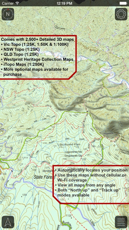
INCLUDES MORE THAN 2,500 3D MAPS

VMS Map Explorer
by VMS Roam 3D
What is it about?
INCLUDES MORE THAN 2,500 3D MAPS!
VMS Map Explorer is $36.99 but there are more add-ons
-
$84.99
WA Topo
App Screenshots
App Store Description
INCLUDES MORE THAN 2,500 3D MAPS!
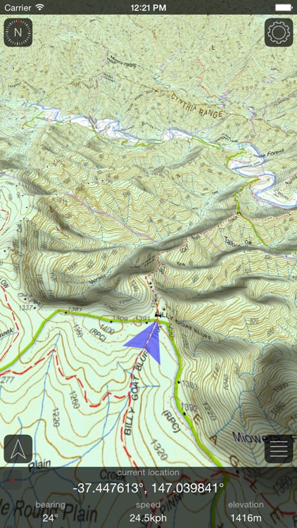
VMS Map Explorer is the world's first offline 4WD navigation app that uses real time 3D topographical maps.
View your exact GPS location on the stunning 3D maps*. Navigate your way through the road/track network and easily determine your location in relation to mountains, valleys and other topographical features. Evaluate a track's gradient at a glance!
See and feel the terrain with the highest-resolution topographic data generated from NASA's Shuttle Radar Topography Mission with 1 arc-second sampling (~30 meters).
Powered by Roam 3D, the app uses your iOS device's full graphics potential with 3D terrain and lighting effects rendered using openGL.
The app includes 2,500+ maps available to download with the option to purchase more. The VIC Topo, NSW Topo, QLD Topo, Westprint and iTopo map sets come included with the app!
FEATURES INCLUDE
- Amazing 3D topographical maps including:
VIC Topo
NSW Topo
QLD Topo
Westprint
iTopo
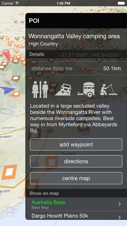
- 1000 searchable Australian Points Of Interest
- More than 180,000 searchable Australian cities, towns, regions and landmarks.
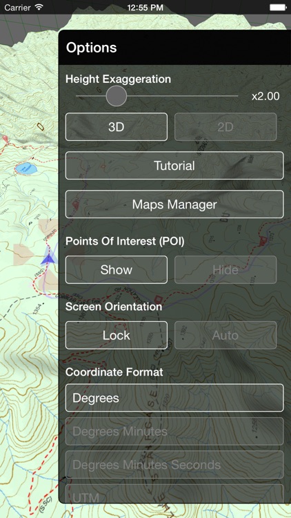
- Adjustable height exaggeration to enhance mountains
- Easily determine the elevation of any point of any map
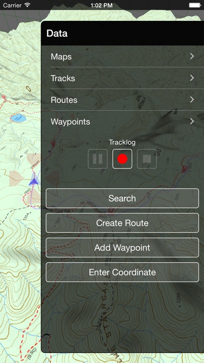
- Record track logs
- Add waypoints at any point on a map, at your current location or by entering a coordinate
- Create routes that follow the 3D terrain
- Create street routing directions to saved waypoints
- Import and export GPX files
- Intuitive gestures for rotating and tilting the 3D map
- Toggle between 2D and 3D mode
Note: Continued use of GPS running in the background can dramatically decrease battery life.
*If you have a WiFi only iPad an external GPS receiver must be used to track your location.
Disclaimer:
AppAdvice does not own this application and only provides images and links contained in the iTunes Search API, to help our users find the best apps to download. If you are the developer of this app and would like your information removed, please send a request to takedown@appadvice.com and your information will be removed.
AppAdvice does not own this application and only provides images and links contained in the iTunes Search API, to help our users find the best apps to download. If you are the developer of this app and would like your information removed, please send a request to takedown@appadvice.com and your information will be removed.