You are using an outdated browser. Please
upgrade your browser to improve your experience.

WeatherGeek Pro 2 is a premium weather application which brings the world’s most advanced weather data right to your fingertips

WeatherGeek Pro 2
by Hurricane Baby, LLC
What is it about?
WeatherGeek Pro 2 is a premium weather application which brings the world’s most advanced weather data right to your fingertips! For the first time on a mobile app, view the same numerical weather models professional meteorologists use to develop their forecasts on our beautiful Retina-quality graphical interface. If you’re a serious WeatherGeek who likes to dive into the data, this is the app you’ve been dreaming of!
WeatherGeek Pro 2 is FREE but there are more add-ons
-
Free
ECMWF Model Interface
-
$1.99
HRRR Model Interface
-
$0.99
Skew-T Chart Interface
-
$0.99
HPC Map Interface
-
$0.99
World & Tropical Region Map Interface
App Screenshots
App Store Description
WeatherGeek Pro 2 is a premium weather application which brings the world’s most advanced weather data right to your fingertips! For the first time on a mobile app, view the same numerical weather models professional meteorologists use to develop their forecasts on our beautiful Retina-quality graphical interface. If you’re a serious WeatherGeek who likes to dive into the data, this is the app you’ve been dreaming of!
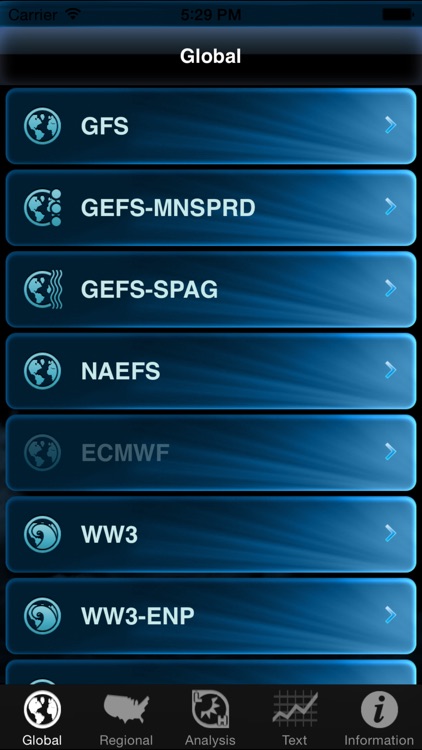
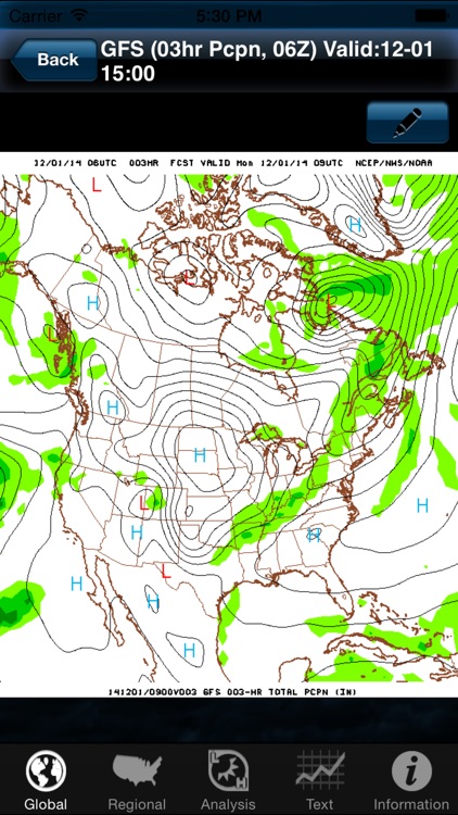
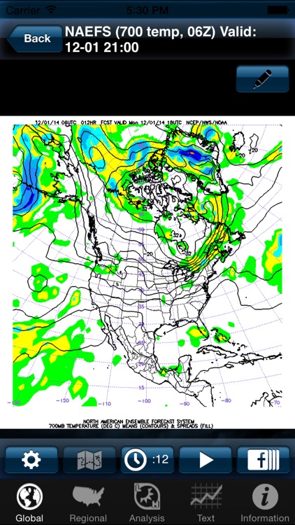
Choose weather maps for North America, South America, Africa, Europe, Asia, Australia and tropical regions* from our “global” suite of models which include the GFS (Global Forecasting System), GEFS (Global Ensemble Forecasting System), the NAEFS (North American Ensemble Forecast System), the WW3 (Wave Watch 3) Model and the ECMWF (European) Model.
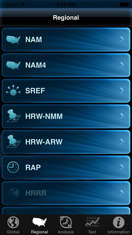
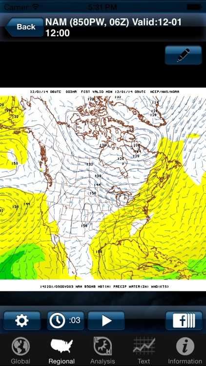
You can also choose “regional” weather maps for North America, the United States and Alaska from the NAM (North American Mesoscale), NAM-HIRES (4km NAM), the SREF (Short Range Ensemble Forecast), the HRW-NMMB, the HRW-ARW (High Resolution Window WRF), and RAP (Rapid Update Model).
View over 70 advanced weather parameters for all regions across the continental United States in stunning Retina-quality high resolution clarity with the HRRR (High Resolution Rapid Refresh) Model interface.**
Scan the atmosphere in three dimensions by checking out skew-t (weather balloon data) charts for the continental United States.**
Not a huge WeatherGeek and want to see more traditional weather maps? No problem! Check out our WPC Interface which allows you to view current and future surface weather maps out to seven days along with QPF (Quantified Precipitation Forecast) maps, and other weather hazard maps for the United States and southern Canada.**
Easily navigate through the maps by simply swiping your finger to advance or go backwards in time. You can also swipe your finger up and down to control which level of the atmosphere you are viewing. To see more detail for your area, easily zoom in and out on the maps by pinching or stretching. Drag your finger around on the map to scroll. Tap the play button to animate the maps and to see weather features progress in time. Draw on the maps using the drawing tool. Best of all, you have the ability to share all of these map images on popular social networking platforms like Twitter with the tap of your finger.
Features:
• Numerical weather model maps for the United States, North America, South America, Africa, North Pacific, East Pacific, Western Atlantic, Atlantic, Europe, Asia, Australia*** and the South Pacific.*
• GFS, GEFS, NAEFS, WW3, POLAR, NAM, NAM4, SREF, HRW-NMMB, HRW-ARW, RAP, ECMWF**, HRRR Experimental** and HRRR Operational** models available.
• Display multiple levels such as surface, 850mb, 700mb, 500mb, 300mb, 250mb, 200mb plus many more.
• View a variety of products such as precipitation, thickness, winds, pressure, vorticity, precipitable water, relative humidity, heights, streamlines and simulated radar.
• Access U.S. and southern Canada weather maps from the WPC (Weather Prediction Center) including current and future surface maps out to 7 days, QPF and weather hazard maps.**
• View skew-t charts (weather balloon data) for stations across the continental U.S.**
• Display upper air maps.
• Zoom and scroll maps.
• Animate maps.
• Draw on maps.
• Share maps on Twitter and via Email.
• Access MOS tables for the U.S. (MAV, MET, MEX, GFS LAMP).
• Instantly access many U.S. National Weather Service text products.
*support for regions other than the U.S. or North America require an in-app purchase
**requires an in-app purchase
For more, please visit our website at www.weathergeekpro.com
Disclaimer:
AppAdvice does not own this application and only provides images and links contained in the iTunes Search API, to help our users find the best apps to download. If you are the developer of this app and would like your information removed, please send a request to takedown@appadvice.com and your information will be removed.
AppAdvice does not own this application and only provides images and links contained in the iTunes Search API, to help our users find the best apps to download. If you are the developer of this app and would like your information removed, please send a request to takedown@appadvice.com and your information will be removed.