You are using an outdated browser. Please
upgrade your browser to improve your experience.

WeatherPlot (™), powered by ClearAg(R), provides seed and crop protection companies, research scientists, and crop insurance companies with a powerful tool to better assess environmental surface conditions at any location of your choosing

WeatherPlot Mobile
by Iteris, Inc.
What is it about?
WeatherPlot (™), powered by ClearAg(R), provides seed and crop protection companies, research scientists, and crop insurance companies with a powerful tool to better assess environmental surface conditions at any location of your choosing. Powered by Iteris’ EMPower meteorological analysis and forecasting system, the retrieval of historical, climatological, and forecast soil and weather information for any location globally is accomplished by simply indicating your location on a map. Easy-to-interpret graphs and tables of different meteorological and soil data are generated for the mapped location with export capabilities to facilitate future analysis.
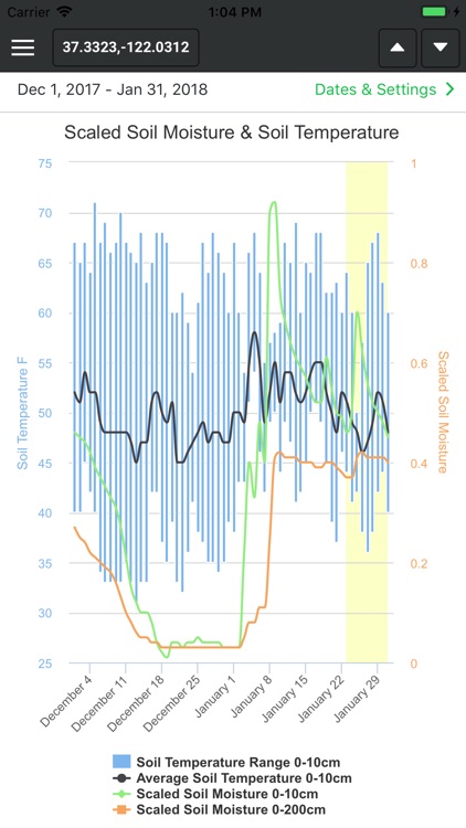
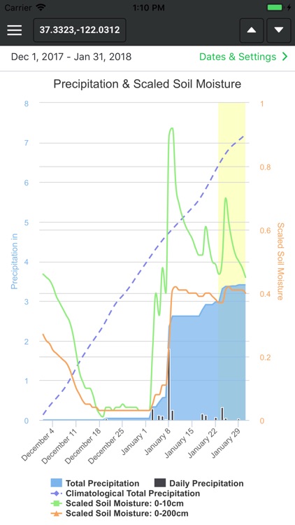
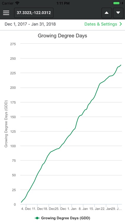
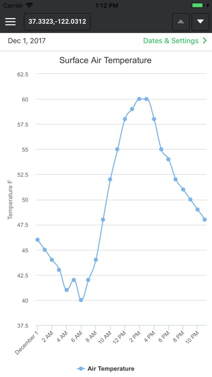
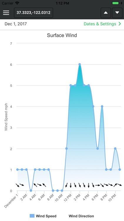
App Screenshots
App Store Description
WeatherPlot (™), powered by ClearAg(R), provides seed and crop protection companies, research scientists, and crop insurance companies with a powerful tool to better assess environmental surface conditions at any location of your choosing. Powered by Iteris’ EMPower meteorological analysis and forecasting system, the retrieval of historical, climatological, and forecast soil and weather information for any location globally is accomplished by simply indicating your location on a map. Easy-to-interpret graphs and tables of different meteorological and soil data are generated for the mapped location with export capabilities to facilitate future analysis.
-- Correlate crop performance with environmental conditions by retrieving meteorology and soil conditions for specific locations of your choosing
-- Assess the departure from normal conditions in self-contained plotting views that show the climatology versus what actually happened at the chosen location (recent vs. average)
-- Plot critical growth parameters such as soil moisture overlaid with soil temperature information
-- Easy-to-use export feature allows you to retrieve the location data and email it to an address of your choosing as a CSV file
-- Identify and plan field operations by plotting forecast information up to nine days into the future
-- Parameters plotted include air temperature, wind speed, wind direction, reference evapotranspiration, solar radiation, relative humidity, cloud cover, precipitation totals, soil moisture, soil temperature, and growing degree days
Disclaimer:
AppAdvice does not own this application and only provides images and links contained in the iTunes Search API, to help our users find the best apps to download. If you are the developer of this app and would like your information removed, please send a request to takedown@appadvice.com and your information will be removed.
AppAdvice does not own this application and only provides images and links contained in the iTunes Search API, to help our users find the best apps to download. If you are the developer of this app and would like your information removed, please send a request to takedown@appadvice.com and your information will be removed.