You are using an outdated browser. Please
upgrade your browser to improve your experience.
The Wildfire and Earthquake Tracker is an interactive mapping application that tracks US wildfires and Global earthquakes

Wildfire & Earthquake Tracker
by corey hoggard
What is it about?
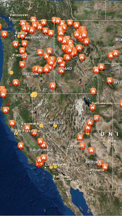
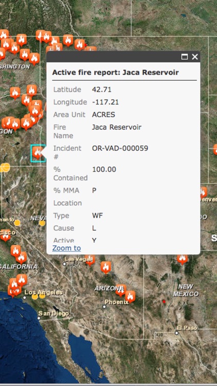
The Wildfire and Earthquake Tracker is an interactive mapping application that tracks US wildfires and Global earthquakes. The data feed comes from the USGS and and US Forestry Service. This map provides you with up to the minute data and access to global wildfire's as well as reported earthquakes.
App Store Description
The Wildfire and Earthquake Tracker is an interactive mapping application that tracks US wildfires and Global earthquakes. The data feed comes from the USGS and and US Forestry Service. This map provides you with up to the minute data and access to global wildfire's as well as reported earthquakes.
-Wildfire Information and Location
-Earthquake Information and Location
-GPS integration
-Interactive Map
-Map Tables with data analysis
Disclaimer:
AppAdvice does not own this application and only provides images and links contained in the iTunes Search API, to help our users find the best apps to download. If you are the developer of this app and would like your information removed, please send a request to takedown@appadvice.com and your information will be removed.
AppAdvice does not own this application and only provides images and links contained in the iTunes Search API, to help our users find the best apps to download. If you are the developer of this app and would like your information removed, please send a request to takedown@appadvice.com and your information will be removed.