You are using an outdated browser. Please
upgrade your browser to improve your experience.

A simple and intuitive navigation app good for helping you find where you parked your car, geocaching, camping, boating, etc

wtfdip
by mark burky
What is it about?
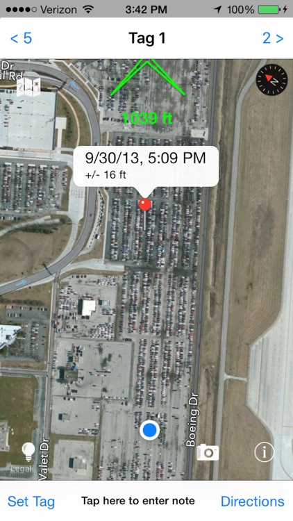
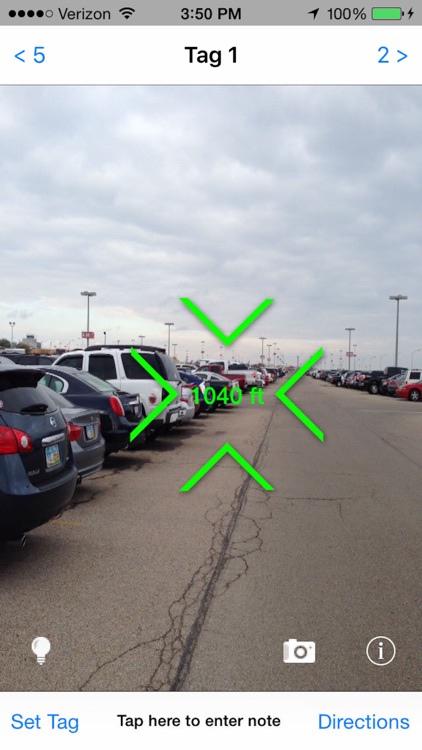
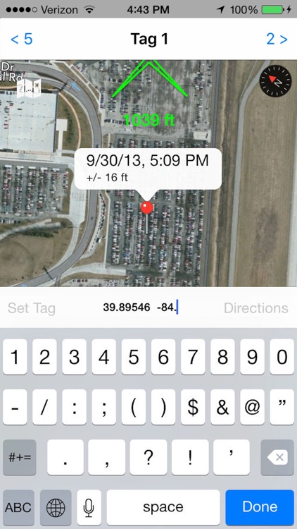
A simple and intuitive navigation app good for helping you find where you parked your car, geocaching, camping, boating, etc. Just stand next to your car (or your tent or the marina or whatever) and tap "Set Tag". For geocaching you can toggle between being able to view/edit the tag note and the tag latitude and longitude coordinates by tapping the green circle "i" button. When you're ready to find your car (tent, marina, geocache, etc. ), open wtfdip and it will fluidly show you the direction and distance to the tag in real time.
App Screenshots
App Store Description
A simple and intuitive navigation app good for helping you find where you parked your car, geocaching, camping, boating, etc. Just stand next to your car (or your tent or the marina or whatever) and tap "Set Tag". For geocaching you can toggle between being able to view/edit the tag note and the tag latitude and longitude coordinates by tapping the green circle "i" button. When you're ready to find your car (tent, marina, geocache, etc. ), open wtfdip and it will fluidly show you the direction and distance to the tag in real time.
Note 1: If you scroll the map away from your current location (so the the current location blinker isn't visible on the map) and tap "Set Tag" the tag is set to the location corresponding to the center of the map instead of your current location. This lets you scroll the map, find points of interest, set a tag, and then use wtfdip to navigate there.
Note 2: After entering geocache information, you can tap "Directions" to launch Maps with directions to the nearest street location to the cache. Once you're there, open wtfdip to home in on the cache with wtfdip's "as the crow flies" pointing navigation.
Note 3: Latitude and Longitude are in the Decimal Degrees format. This means latitude is one number between -90 and 90 and longitude is one number between -180 and 180. Enter them separated by a space with latitude first.
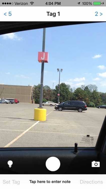
Note 4: Altitude information is not used for pointing (doesn't perform well during testing) and GPS signals can be distorted indoors, so if you want to use wtfdip to remember where you parked in, for instance, a car garage the best thing to do might be to use the note to take down the nearest section (like "C23" or something).
Note 5: The ability to view/edit the latitude and longitude coordinates is not yet available in the Arabic or Hebrew versions.
We use several icons from www.glyphish.com
Disclaimer:
AppAdvice does not own this application and only provides images and links contained in the iTunes Search API, to help our users find the best apps to download. If you are the developer of this app and would like your information removed, please send a request to takedown@appadvice.com and your information will be removed.
AppAdvice does not own this application and only provides images and links contained in the iTunes Search API, to help our users find the best apps to download. If you are the developer of this app and would like your information removed, please send a request to takedown@appadvice.com and your information will be removed.