You are using an outdated browser. Please
upgrade your browser to improve your experience.

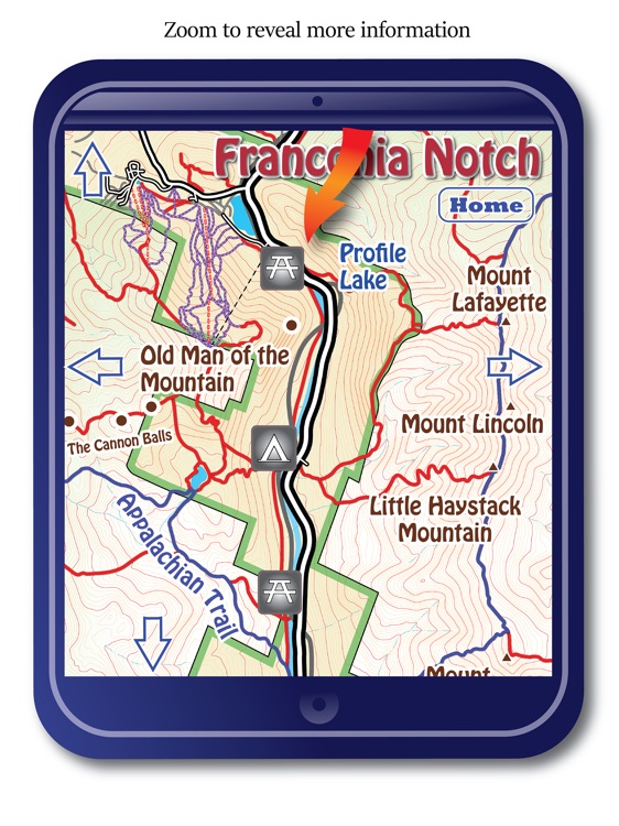
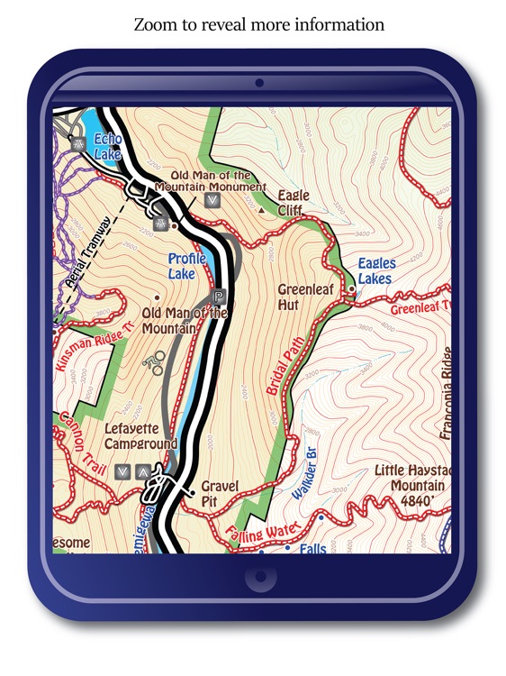
YouHike - The White Mountains-HD for the iPad offers 28 zoomable interactive trail maps of the state and National Parks around the White Mountains, in New Hampshire & Maine

YouHike - The White Mountains - HD
by Hawaii-Apps
What is it about?
YouHike - The White Mountains-HD for the iPad offers 28 zoomable interactive trail maps of the state and National Parks around the White Mountains, in New Hampshire & Maine.
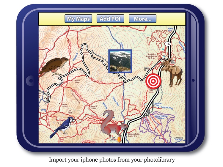
App Screenshots
App Store Description
YouHike - The White Mountains-HD for the iPad offers 28 zoomable interactive trail maps of the state and National Parks around the White Mountains, in New Hampshire & Maine.
**For your location to appear on these maps you need to have a gps enabled device or be within range of a WIFI source.
With YouHike The-White-Mountains you can:
* zoom in to present more detailed information.
* keep track of your location, even if you are out of cell phone range.
* record information about 'Points of Interest' (POIs) you find along your hike. You can save and export your 'POI' information as a text file, or send your 'POI's to other YouHike users.
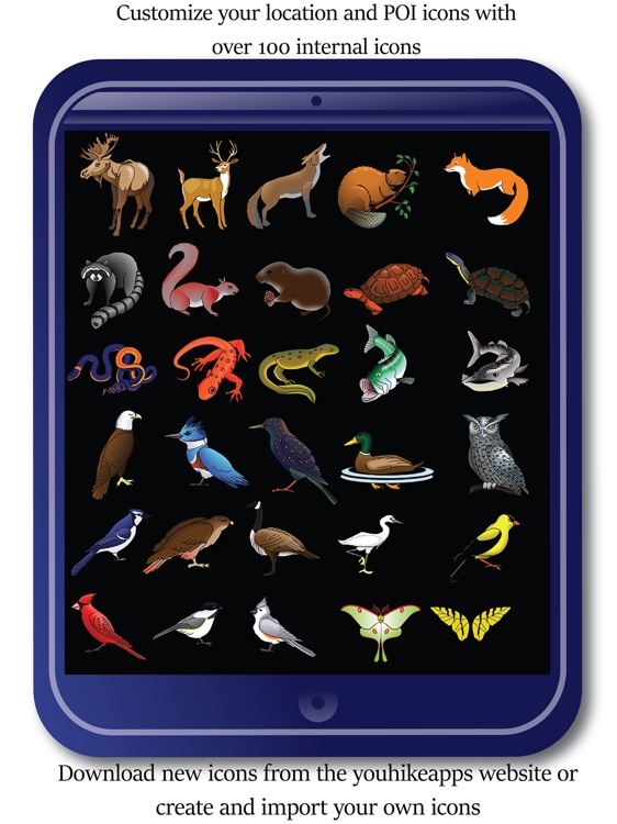
* customize your location and 'POI' graphics with over 100 internal icons.
* download more icons from the youhikeapps.com website, or create and import your own icons.
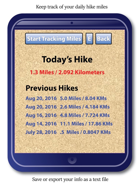
* track your daily hike miles, save and email your stats.
* import your photos from your device's photolibrary and have them appear on-screen in the map location they were taken.
* send your location to other YouHike users.
* use iCloud to sync your 'POI' data between your iPhone and iPad.
YouHike The-White-Mountains covers over 150 miles of hiking and biking trails around the White Mountains including:
Bartlett, Bethal, Bretton Woods, Conway, Crawford Notch, Franconia, Franconia Notch, Gilead, Gorham, Groveton, Haverhill, Jackson, Kancamagus Scenic Highway, Lincoln, Mount Adams, Mount Chocorua, Mount Washington, Mount Washington summit, Mount Wonalancet, Stow, Tripoli Road, Twin Mountain, Waterville Valley, Wentworth, West Milan, White Mountains - full map, Eastern White Mountains, Western White Mountains, & Woodstock.
**Continued use of GPS running in the background can dramatically decrease battery life.
**You need to have a device with activated gps in order to get your location, or be within range of WIFI.
Disclaimer:
AppAdvice does not own this application and only provides images and links contained in the iTunes Search API, to help our users find the best apps to download. If you are the developer of this app and would like your information removed, please send a request to takedown@appadvice.com and your information will be removed.
AppAdvice does not own this application and only provides images and links contained in the iTunes Search API, to help our users find the best apps to download. If you are the developer of this app and would like your information removed, please send a request to takedown@appadvice.com and your information will be removed.