You are using an outdated browser. Please
upgrade your browser to improve your experience.

The ultimate interactive hiking map & planner packed with trails and data

Zmeu Sipoonkorpi
by Alexandru Ioan Tomescu
What is it about?
The ultimate interactive hiking map & planner packed with trails and data. Measure any trail you want and see the remaining time to any point, even offline. Designed by hikers for hikers!
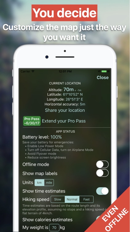
App Screenshots
App Store Description
The ultimate interactive hiking map & planner packed with trails and data. Measure any trail you want and see the remaining time to any point, even offline. Designed by hikers for hikers!
Zmeu was featured on:
• Most downloaded app on the Finnish App Store (30 July 2016)
• Helsingin Sanomat newspaper - Matka section
Zmeu Sipoonkorpi contains:
• many hiking trails (more than 150 km) in the Sipoonkorpi National Park, Finland
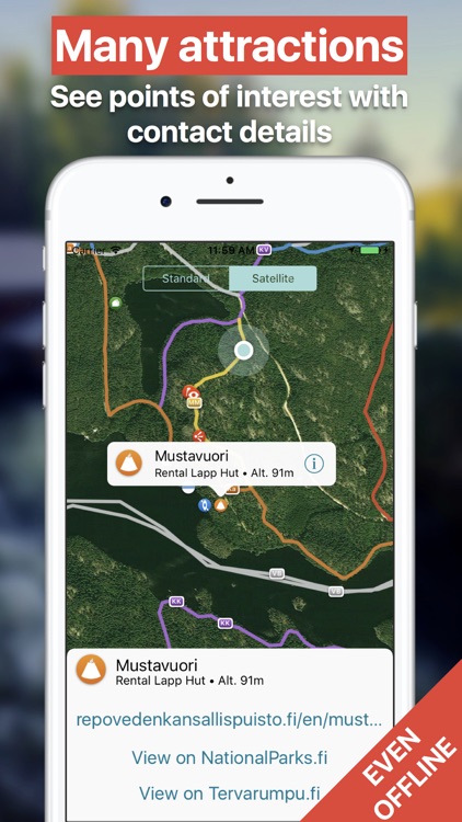
• 50 attractions and points of interest, with relevant weblinks
• hidden places and routes (unknown to Google Maps)
• data from OpenStreetMap with additional manual curation and validation against official sources
• Offline mode: all routes and attractions are stored on your device and are available offline; an Internet connection is required for the background map tiles
••• You need the Pro Pass to access all features
••• 60-minute free trial available
Plan your trip:
• get public transport directions to many bus stops around Sipoonkorpi (via Reittiopas.fi)
• get driving directions to parking places
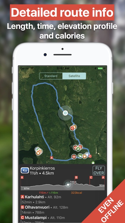
• [Pro Pass] see the length, elevation profile, total ascent and descent, time and calories estimates for all hiking routes
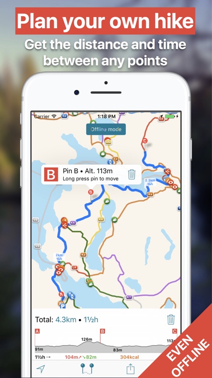
• [Pro Pass] measure distance and time along existing hiking routes, between any points you choose, even in Offline mode
• [Pro Pass] see the altitude and geographic coordinates of any point on any hiking route
• get driving directions to parking places
While you hike:
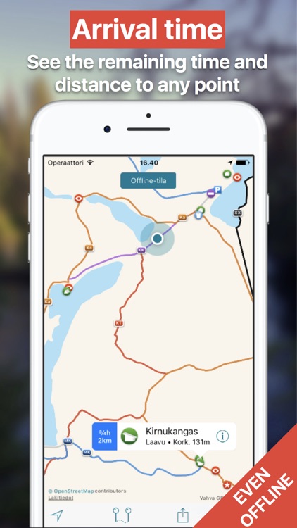
• NEW: [Pro Pass] see the remaining time and distance to any location, even offline; tap on it for directions
• [Pro Pass] see your map location, geographic coordinates and altitude
• [Pro Pass] send your position on the map to friends
• see your battery level and get warnings and tips about saving it
By using Zmeu you support further development! We are very grateful for any comments, feedback and ideas sent to contact@zmeu.guide.
------------------
Other information:
• Zmeu uses data that is ©OpenStreetMaps contributors. See the full legal information at http://suomi.zmeu.guide/legal.html
• Routes and points of interest are always stored your the device. Distance measurement is done on your device, without requiring an Internet connection.
• An Internet connection is required for the background map tiles, the FLYOVER mode, and for getting driving directions to the parking places (via the Apple Maps app).
• Zmeu is not affiliated with Metsähallitus.
Disclaimer:
AppAdvice does not own this application and only provides images and links contained in the iTunes Search API, to help our users find the best apps to download. If you are the developer of this app and would like your information removed, please send a request to takedown@appadvice.com and your information will be removed.
AppAdvice does not own this application and only provides images and links contained in the iTunes Search API, to help our users find the best apps to download. If you are the developer of this app and would like your information removed, please send a request to takedown@appadvice.com and your information will be removed.