You are using an outdated browser. Please upgrade your browser to improve your experience.

Wonder How Far It Is From one Place To Another

These apps are great for calculating the distances and/or area on a map. Find out the measurement or how long it might take to reach a destination.

Measure Map Pro
Agro Measure Map Pro
Distance - Find My Distance

Best Apps

Highest scored apps in the category

Measure Map Pro
Measure Map Pro

Measure Map Pro

Blue Blink One, SL

Measure Map Pro lets you quickly and easily measure multiple distances, perimeters and areas with laser sharp precision

Measure Map Pro lets you quickly and easily measure multiple distances, perimeters and areas with laser sharp precision!. Use it for small areas or large, then share with coworkers. Click “...More” to learn why you should download this App today!

Calculate surface areas, buildings, plots, floors, forest areas or dimensions for fencing, sports tours, trips or anything you need for...

Agro Measure Map Pro

Agro Measure Map Pro

Blue Blink One, SL

Agro Measure Map Pro lets you quickly and easily measure multiple distances, perimeters and areas with laser sharp precision

Agro Measure Map Pro lets you quickly and easily measure multiple distances, perimeters and areas with laser sharp precision! It even takes into account the curvature of the earth’s surface. Use it for small areas or large, then share your findings via iTunes or email. Click “...More” to learn why you should download this App today!

Calculate surface areas, fields,...

Distance - Find My Distance

Distance

Mapnitude Company Limited

Introducing our enhanced distance measurement app

Introducing our enhanced distance measurement app! With added features such as area measurement and custom coefficients, this app takes accurate measurements to a whole new level.

Usage:
Measuring distance is now a breeze. Simply touch the screen to draw a route on the map and instantly calculate its length. Our magnifier tool ensures precise drawing and measurement.
◆ Easily switch between Move and...

DistancePinner
DistancePinner

DistancePinner

Mapnitude Company Limited

Find the distance between locations on the map easily with this app

Find the distance between locations on the map easily with this app.
The information provided by this app facilitates your travel route plan, help you to find the shortest way, etc.


## Simple Design ##
Simply move and drag the map around and drop pins to start measuring the distance.


## Distance Tracking Mode ##
You can use your device's GPS feature to...

Area & Distance - Map Measure

Area & Distance

Mapnitude Company Limited

Measuring area and distance on the map, made easy with this app

Measuring area and distance on the map, made easy with this app.

## Usage ##
Press "+" button or press and hold screen to drop a pin.
- App will determine distance between points when pins are placed on the map.
- After placing three or more pin, area inside those pins will be calculated. You can make changes by dragging existing pin around...

Coordinates - GPS Formatter

Coordinates

Mapnitude Company Limited

Simple and Easy App to determine various-format coordinates

Simple and Easy App to determine various-format coordinates

# User-friendly Design #
Your current location will automatically appear as the point of intersection of two grey lines, and can also be manually indicated via value-input, location search, and import from clipboard functions as well.

# Support of Various Coordinate Formats #
Not only the app specifies Longitude / Latitude, but also supports...

Also Good

Apps with average score

Distances - Map Ruler

Distances - Map Ruler

Emidio Cunha

Measure distances on a map, simply by drawing!

If you draw a closed figure, it will also display the area!

Distances and Areas are expressed in meters, kilometres as well as feet and miles, and the units can be changed by tapping on them! 

Now you can even estimate the area being drawn...

Planimeter — Measure Land Area

Planimeter — Measure Land Area

Core Signals

Planimeter - Measure Map Distance and Land Area is the essential app. The app is universal so it will run great on both iPhones and iPads. The only problem we found with the app is that it can take longer to load maps than the built-in maps app. We are...

Mapulator - GPS Field Measure

Mapulator - GPS Field Measure

LogiSian Technology Solutions

A powerful and best tool for measuring map area and distance on any device. Effortlessly calculate land or farm areas and measure distances with just a few taps. Get accurate measurements for backyards, fields, or outdoor activities. Draw lines on the map or use GPS for precise results. Seamlessly switch...

Fields Area Measurement

Fields Area Measurement

Bhavik Savaliya

Fields area Measure is a smart tool for measuring areas on the map. Once you place your points on the map and then calculate area between all point. you can also calculate total Area of ant Route.

Fields Area Measurement is useful to calculate GPS area or GPS distance with great...

Distance Measure Pro

Distance Measure Pro

RBetjes

This app lets you measure the point-to-point (great-circle) distance between two or more waypoints on a map or measure the surface area defined by a polygon having three or more points as its corners.
It uses online maps so it needs an internet connection.

Tap and hold to set a new waypoint,...

Distances To
Distances To
Distances To

Distances To

Danny Pajevic

Distances To provides a way to calculate driving distances, flight distance, fuel cost, land elevation, route elevation, travel time and more. Note that an internet connection is required.

With support for countries all around the world, you can calculate the distance to, from and between cities, towns, villages and/or countries. Calculations...

Geo Measure Area Calculator

Geo Measure Area Calculator

BMAC Infotech

Geo Measure is the best free tool for field measurement when you want to purchase some property, and want to calculate the area of that property. Geo Measure will help you like your best friends and will give you exact calculated area. App is useful to calculate GPS area or...

Distance Measure
Distance Measure
Distance Measure

Distance Measure

RBetjes

This app lets you measure the point-to-point (great-circle) distance between two or more waypoints on a map or measure the surface area defined by a polygon having three or more points as its corners.
It uses online maps so it needs an internet connection.

Tap and hold to set a new waypoint,...

Planimeter GPS Area Measure

Planimeter GPS Area Measure

VisTech.Projects LLC

Planimeter is a tool to measure distance, area and perimeter on a map. You can measure manually or by GPS tracking. You can also check the bearing and geo-coordinates of your location and share it. Points can be labeled, saved and shared in KML format.

This measurement app is useful...

Farness
Farness
Farness

Farness

Apperdashery LLC

Farness helps you quickly and easily measure distance on a map by dropping pins or drawing a path.

Features:
- Tap "+" to drop pins
- Drag your finger or use Apple Pencil to draw a path
- Find the total distance and distance in between locations
- Search for...

Plan your road trip
Pin Points Distance Calculator

Pin Points Distance Calculator

Dennis Donner

Do you want to know the distance to the South Pole? Do you want to plan your next trip and do you want to know and save which places you want to visit and how much distance lies in between them? Or are you rather interested in the distance between two...

Map Calculator tool
Map Calculator tool
Map Calculator tool

Map Calculator tool

Dima Bart

***No In-App purchases, no hidden costs! One price, all features, free regular updates, for life.***

Whether you need to measure distance from point A to point B, compose complex distance paths or simply measure an area of a soccer field, Map Calculator will help you do that and much more with...

Measure distance on map. Land

Measure distance on map. Land

Andrey Rozhkov

Measure length of anything on map, even if there is no routes or ground.
If you want to measure your route without roads - this is that you need!
Measure roads, buildings or lands from the bird's eye view.
Tap to map to add route points - get accurate calculations of distance.

How...

Planimeter for map measure

Planimeter for map measure

zhong zhang

Planimeter is a tool to measure distance and area on map.
It can measure anything visible on the satellite map, like lawns, fences, farm, road, roofs and so on.

~~~~~~~~~~~~~~~~~~~~~~~~~~~~~~~~~~~~
● Thanks to more than 3250,000 people who have chosen "Planimeter Pro"
● "GREAT - Wonderful app. Very useful and easy to use. Most...

DistanceMap
DistanceMap
DistanceMap

DistanceMap

John Sherman

DistanceMap or DistanceMap HD is the best alternative to Planimeter. Cost stops it from rivaling the essential app. To get the app on both your iPad and iPhone it will cost you $5.99. Planimeter is an essential app for half the cost of that combo. The app includes many of...

Area Distance Measuring Tool

Area Distance Measuring Tool

seawellsoft

***A simple tool to measure area, perimeter and distance. it will allow you to measure only area no matter what shape it is…
***Calculate the area for any arbitrarily shaped area of land such as polygon, triangle, hexagon etc…
***The app is useful to calculate GPS Area perimeter and distance with great...

Area Calculator Pro +

Area Calculator Pro +

Nicolas Schotten

Area Calculator Pro is a great app to calculate areas between points on the map.

You can create any number of pins on the map. The app calculates the area between them automatically.

More Functions:
- You can locate yourself and create a pin at your current location with only one click.
- You...

Compare many path
Planimeter Pro for map measure

Planimeter Pro for map measure

zhong zhang

Planimeter is a tool to measure distance and area on map.
It can measure anything visible on the satellite map, like lawns, fences, farm, road, roofs and so on.

~~~~~~~~~~~~~~~~~~~~~~~~~~~~~~~~~~~~
● Thanks to more than 3250,000 people who have chosen "Planimeter Pro"
● "GREAT - Wonderful app. Very useful and easy to use. Most...

CoordCalc
CoordCalc
CoordCalc

CoordCalc

Justin Time

A coordinate utility app that calculates the distance and initial/final bearings between two points on Earth specified either manually by latitude and longitude or automatically using the built-in map. It can also calculate a final position given an initial position, distance, and bearing.

################################
Limited time sale, get it now before the...

Planimeter PRO HD
Planimeter PRO HD
Planimeter PRO HD

Planimeter PRO HD

Velibor Santic

DESCRIPTION
Planimeter is a powerful tool to measure and calculate distance between multiple points on the map, and land area, all expressed in the measuring units you choose. This app uses Apple Maps, GPS and Network location services, ideal companion wherever you go.
Keep in mind that GPS works best...

Distance Calculator Pro

Distance Calculator Pro

Nicolas Schotten

Distance Calculator Pro is a great app to calculate distances between points on the map.

You can create an unlimited number of pins on the map. The app calculates their distances automatically.

More Functions:
- You can locate yourself and create a pin at your current location with only one click.
- You can...

Distance Measurement

Distance Measurement

Nanshu Kaneshiro

"Distance Measurement" is the application that can measure distance by tracing on the map with your finger.
Units are both "km" and "mile".

【FUNCTION】
- Measurement of distance by tracing a finger on the map
- Search
- Present location

Because it is simple, it is an application easy to use.

Distance and Area Measure

Distance and Area Measure

TappiApps

Measure land, roads, parks, countries, lakes, etc from a satellite view. Calculates distances, areas, and perimeters.

Features that this application offers that most competitors do not:
- Add custom distance and area units.
- Draw interior polygons. For example, land area with bodies of water removed.
- Add a point to the middle of...

Other Apps

Could be good for special cases

Best Area

Best Area

Oliver Kuehne

Our app facilitates field survey and enables you to determine distances and areas on a map.

Fields of application are measuring of floor space, lawn, fencing, asphalt coatings, forest areas, squares, buildings, landscape, flat roofs, etc. At the same time, measuring distances is possible for walking distances or routes covered by bicycle or car.

‚Best Area‘ offers the same functionality as ‚Best Area Pro‘. However, advertising will be displayed and the number of places is limited to nine.

Our app offers the following features:
- Measuring distances and areas
- Several option for entering locations
- Navigation function
- Automatic recognition of areas
- GPX import/export
- Switching between metrical and imperial measuring system
- Support of diverse maps

Entering locations:
- Directly from point in map
- Typing in address with automatic recognition
- Location of photo
- From existing area

Possible navigations:
- Apple Maps
- Google Maps
- Navigon
- Waze
- TomTom

Geo Measure (Distance & Areas)

Geo Measure (Distance & Areas)

Vishwam B

This map is useful for everyone. Land Surveyors, Real Estate Professionals for measuring land, Boaters & Hikers and recreational activists to draw waypoints, travellers, new land buyers, businessmen etc.

New Geo-Measure helps create (Lines & Polygons) to measure "Distances & Areas" on map more easier than before.

:- Add unlimited markers to draw and measure map lines or regions.
:- Create and Store Lines and Polygons (Areas).
:- Email Area or Distance in KML format.
:- Manage Drawings (Load, Send or Remove).
:- Accurate Measurement Results.
:- GPS User Tracking functionality.
:- Map Local Search functionality.
:- Most frequently used Units for measurement of Areas and Distances.
:- Handy Settings, any changes made will apply instantly. Need not have to redraw.

Please note that internet connection is required for map and search features.

Geo Measure It

Geo Measure It

Computer Services Y Mas LLC

Geo Measure It lets you calculate geographical areas and distances on your iPhone/iPad. It is a simple tool that allows you to draw one or more lines on the map and measure its distance. For example, you can measure the mileage between two cities. Also, this tool can be used to measure the enclosed area of a draw shape/polyline on the map. Quickly and easily outline a property on the map and find its area, for instance. Both the English (the United States customary) System of measurement and Metric System are available.

Share your findings with others via Twitter, Facebook, email, SMS, AirDrop, and Flickr.

Features:

-Measure areas and distances using only your phone or tablet
-Easily and quickly tap anywhere on the map to create a path you want to measure
-Option to move dropped pin and automatically update new distance/area based on changed pin
-Save your findings to review them later
-Share your calculated results with others
- SI Metric and US Standard system of measurements are available

AtoB Distance Calculator Free - easy and fast air or car route measurement from A to B for travel and more

AtoB Distance Calculator Free - easy and fast air or car route measurement from A to B for travel and more

Bernhard Obereder

Number 1 in category „Navigation“ in Germany, Austria, Italy, Argentina, Belgium, Brazil, France, Honduras, Lebanon, Luxembourg, Madagascar, Mexico, Moldavia, Paraguay, Spain, Switzerland and UK
Top 10 in more than 40 countries including the US
Number 1 over all App in Austria, Spain and France

„...AtoB Distance Calculator is a well crafted tool“ — appgefahren

„...very recommended for private and business usage“ — apps4success

„...fills in the gaps left by the other apps“ — Softwarelint

Ever wondered how far away the Everest really is? How long the route from the most northern to the most southern point of Europe is? AtoB Distance Calculator offers you the possibility to easily calculate the flight and driving distances between any two or more points of interest. You can also post the result on Facebook and show your friends back home in the cold winter how far they would have to travel to meet up with you on the sunny islands of Hawaii.
Features:

• calculate flight distance between two or more points (up to 10 points)
• calculate route distance between two or more points (up to 10 points)
• show results on a map
• in km, miles and nautical miles
• post your routes & maps on Facebook and Twitter
• share your routes & maps via E-mail and SMS
• save your maps in Camera Roll
• save favorites

PRO

• view your history of previous calculated routes
• supports your current location
• shows details of every point
• supports searching points via longitude and latitude
• calculates the duration for air distances with given speed
• shows duration of route distance
• can search landmarks and sights
• add points to your favorites by tap and hold
• edit favorites by tap and hold
• delete favorites and history by swipe to delete


What customers say:

„Great app for truck drivers. And good customer service.“ — Jimsj4

„A truly great app it comes use on a regular basis, highly recommended to download for the heavy traveller.“ — Shokat McClintock

„Perfect. Exactly what I was missing !!!“ — Barbie Prinzessin

„Sehr gut, schnell und präzise! Das gefallt mir!“ — Sophisticated Rulf

„Awesome app! Due to calculation of flight distance perfect for pilotes!“ — FloS8010

Follow us on Facebook and Twitter for news:
• facebook.com/AtoBDistanceCalculator
• twitter.com/AtoBapp

AreaMap-Lite

AreaMap-Lite

Antonino D'Angelo

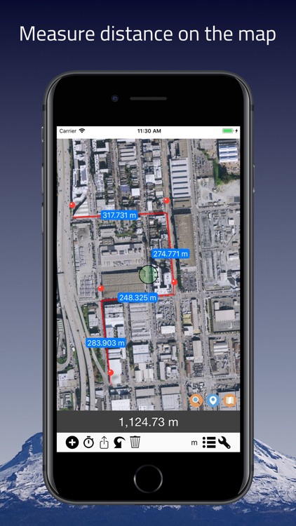
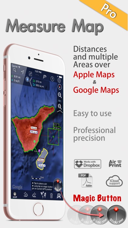
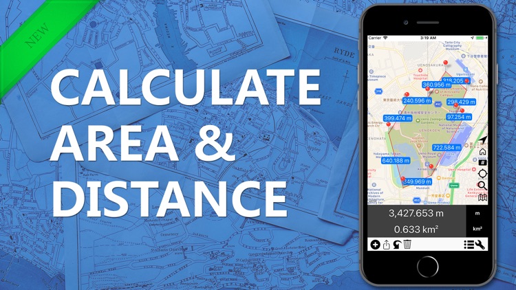
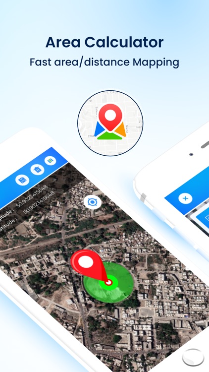
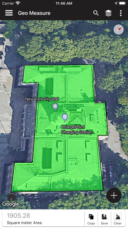
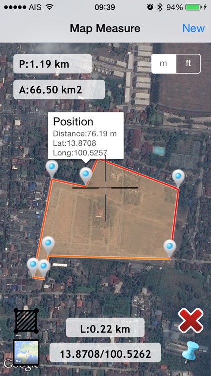
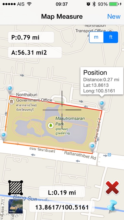
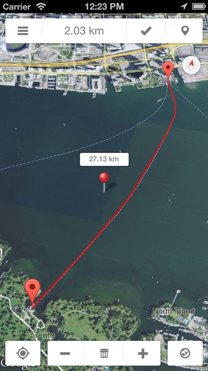
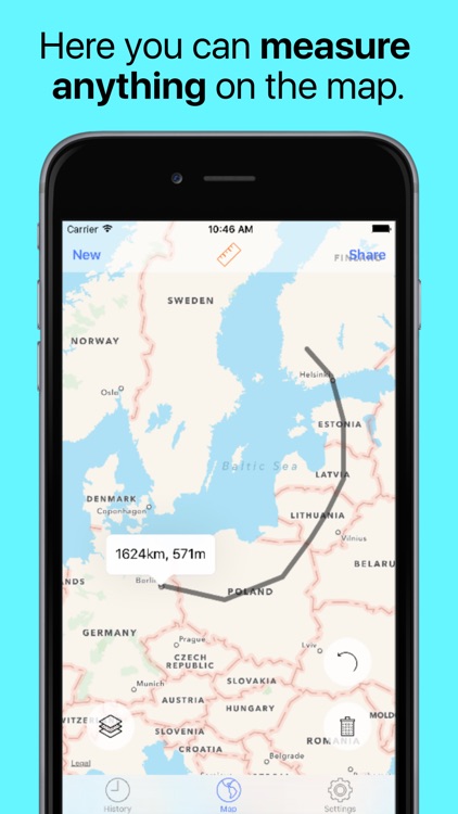
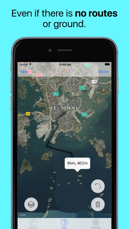
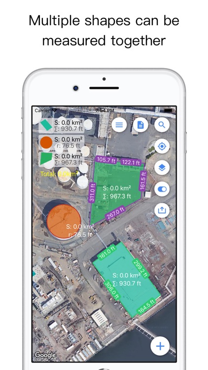
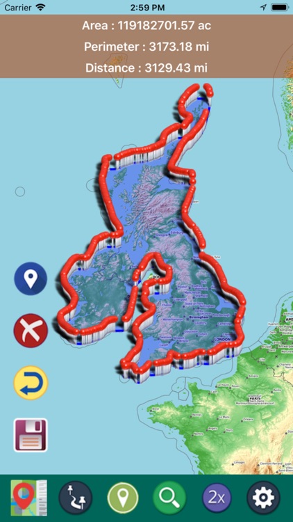
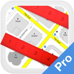
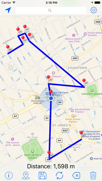
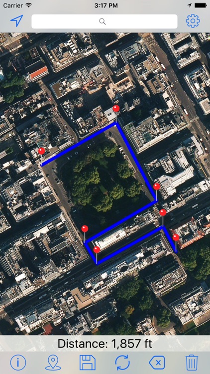
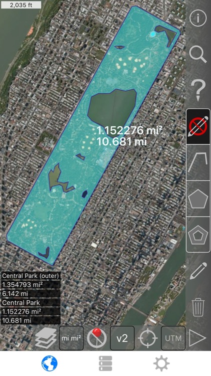
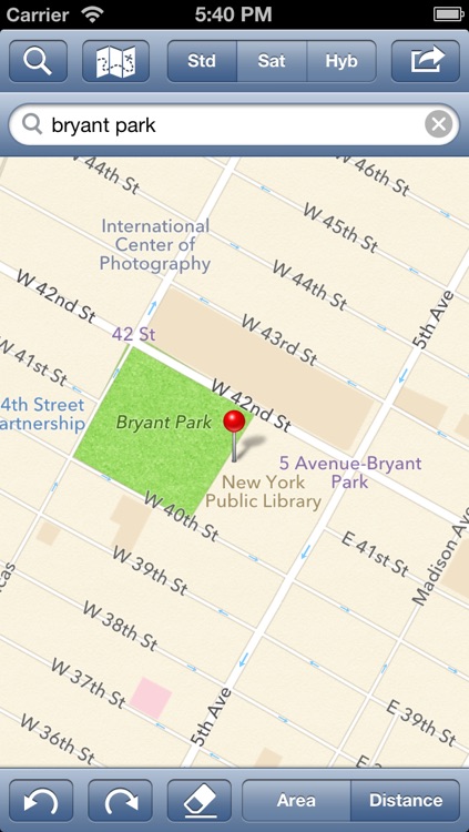
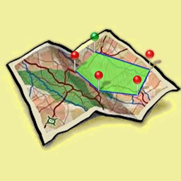
AreaMap-Lite allows you to measure the perimeter and the area of anything is visible on Googl.Maps.

This app is the free version of AreaMap-Pro, and then allows you to test out his duties without spending a dollar.

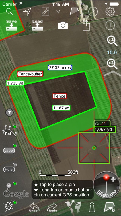
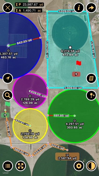
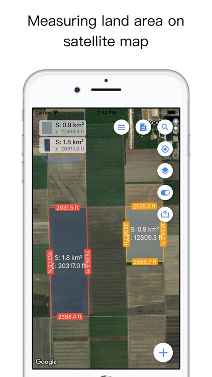
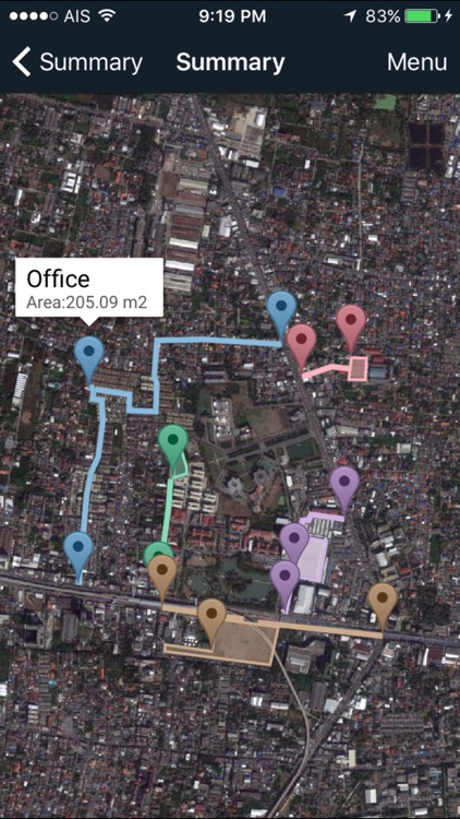
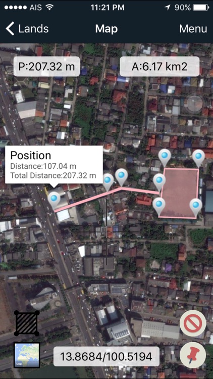
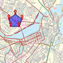
This app is designed to measure plots of land visible from satellite maps.
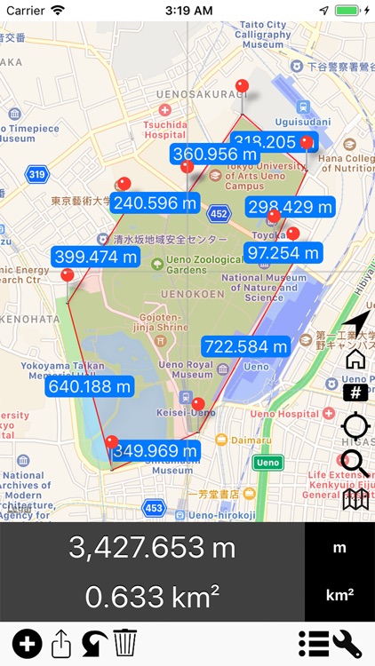
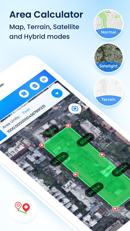
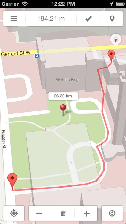
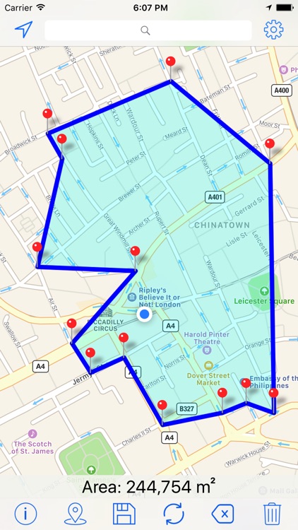
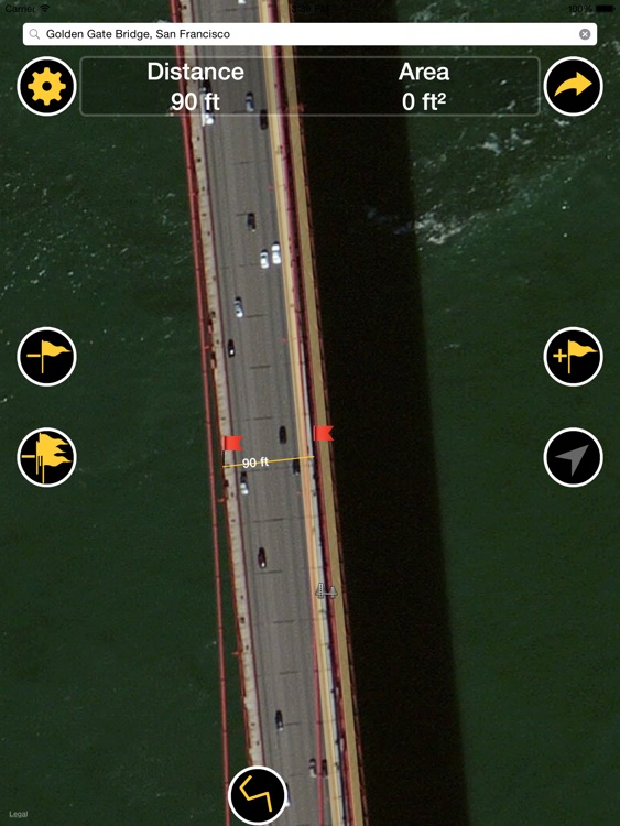
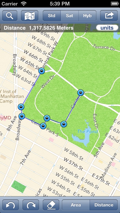
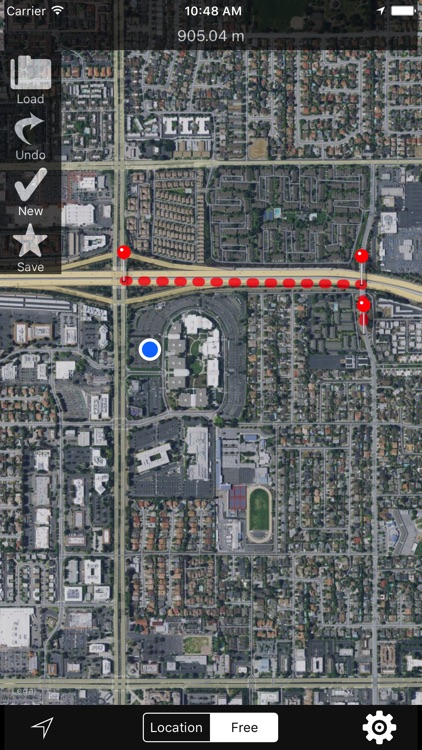
Just move your finger on the "viewfinder" that appears on the map and add the PIN that delimit the land.
Will be calculated in real time, the distance between the added pin and the above, the perimeter and area.

You can move the map left holding the viewfinder and add the same pins.

It can be used to measure industrial areas, halls, gardens, parks, race tracks, length of roads, all that is visible on Googl.Maps.

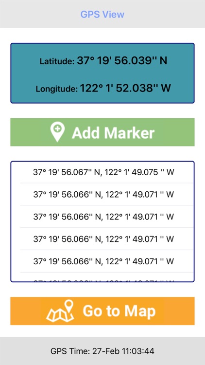
Each measure is added to a table, which can be saved.

Characteristic parameters:
* iOS 5 Ready
* Languages​​: ITALIAN, ENGLISH, FRENCH
* Table: add, edit, delete items
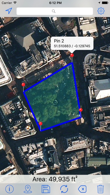
* Map Display: Standard, Satellite, Hybrid
* PIN: add, delete, move, rename
* Position: Latitude and Longitude of each pin
* Length: meters, kilometers, yards, nautical miles
* Area: square meters, hectares, square kilometers, acres
* Line Colors: red, blue, green, yellow, magenta, black
* Area Colors: red, blue, green, yellow, magenta, black
* Viewfinder: On / Off
* Area: On / Off
* Pin: On / Off
* Top panel: shifts automatically, depending on the viewfinder
* Table items measured: No limit *** (Pro version only) ***
* Pin Number: No Limit *** (Pro version only) ***

In the Lite version:
* Maximum 5 (five) Pin to delimit an area
* Maximum 3 (three) elements in the table
* Banner Advertising

***************
AreaMap-Pro is available on the App Store
***************

Map Points - GPS Location Storage for Hunting, Fishing and Camping with Map Area Measurement

Map Points - GPS Location Storage for Hunting, Fishing and Camping with Map Area Measurement

David Morneault

Want to store custom locations? mapPoints will store all of your favorite locations in one spot. This app is great for traveling, if you would like to store your locations and take a snapshot of where you were. It is also great for hunting or fishing or any activity that a specific coordinate is needed. There are four ways you can store your location -

1. Your current location.
2. You can enter an address.
3. You can store a custom latitude and longitude coordinate.
4. You can drop a pin on the map where ever you would like.

The location information is all editable after you store it.

There is an option to draw lines between the map location displayed on the map. You can draw a line between all of the locations in the order selected including the user location. You can draw a line from the user location to the last location selected. You can draw a line form the user location to the first location selected. And you can draw a line between all of the points excluding the user location. This last option is handy when trying to compute distance on a map. When drawing any lines on the map, the distance is displayed in the lower right corner of the screen.

There is a meter on the main page that measures the accuracy of the GPS signal.

You can display your heading and altitude on the main page as an option.

Measure on Map

Measure on Map

VIDUR

The most accurate measurement app in App Store!!

With this app you cane measure any Area or Distance on the map with highest Accuracy.

The app measures any distance, route, or area you want, over Maps. Want to calculate your drive on the golf course, or maybe find out the distance of that marathon you’re thinking of entering? Go ahead. Need to know the size of a parcel of arable land for your company? You can do that, too.

Measure Map is perfect for both professional and personal uses. You can rely on the data it gives you

Our Uncluttered design provides a good balance between simplicity and functionality. Check it out for yourself.

How To use:
-Zoom o your desired location on the map
-select you map mode and units from settings
-select your tool area or Line
-Tap along the outline of the object you want to measure
-you can re adjust the pins by dragging them
-The app will automatically shows the respective accurate results.

Features:
-Universal Design
-You can Drag the point on map
-Support Different Units
-Support multiple map modes
-Share on Facebook or Twitter
-Send results as a Email
-No ads


Note:This App Requires an Internet connection (3G or WiFi)