


KPRC Hurricane Tracker 2
Graham Media Group, Inc
The KPRC 2 Storm Tracker team is here to keep you safe. Our Storm Tracker Hurricane app has everything you need to protect your family, your pets, and your home.
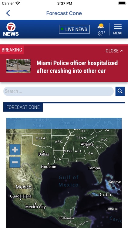
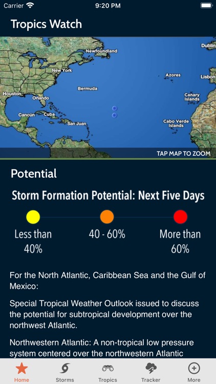
· Projected hurricane paths and tracking with interactive map
· Survival checklists to plan and prepare for storms
· Evacuation routes and live...