You are using an outdated browser. Please
upgrade your browser to improve your experience.

Upgrade to High Definition Navigation & Relief Shading Fishing Charts

Fish Fathom: HD Coastal Charts
by BOATGLIDER, LLC


What is it about?
Upgrade to High Definition Navigation & Relief Shading Fishing Charts! Say goodbye to pixelation and guesswork; see the bottom clearly and reel in more fish
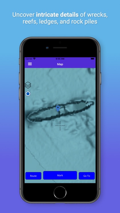
App Screenshots


App Store Description
Upgrade to High Definition Navigation & Relief Shading Fishing Charts! Say goodbye to pixelation and guesswork; see the bottom clearly and reel in more fish
Marine Navigation with Waypoints, Routes, and High Definition Bathymetry Relief Shading
Embark on your coastal adventures with Fish Fathom, the ultimate companion for enthusiasts of marine activities like boating, fishing, and diving. Navigate the seas with confidence using our intuitive app, equipped with high definition maps that reveal intricate bottom structures with unprecedented detail uncovering hidden underwater fishing spots including rock piles, ledges, reefs, wrecks and other hard to see obstructions. Craft personalized routes and waypoints effortlessly from the comfort of your couch, ensuring your fishing journey is tailored to the targeted species for the day.
Whether you're charting a course for your next fishing expedition or seeking the perfect dive spot, Fish Fathom is your trusted guide to the wonders of coastal waters. Download now and elevate your fishing game!
Features -
- Offline NOAA ENC Navigational Charts & Relief Shading
- High Definition Bathymetry Relief Shading map layer allows you to see more details of bottom structure such as ledges, reefs, rock piles, and wrecks so you can find and catch more fish.
- High Definition Navigation Chart map layer provides granular depth information and detailed map features like public reefs, wrecks, channels, marker buoys and other marine points of interest
- Create and Manage Unlimited Routes and Waypoints
- Navigate to Waypoints and Routes using Course Up or North up while monitoring your speed and distance until destination
- Waypoint Formats include both DMS (Degrees Minutes Seconds) and DD (Decimal Degrees) so you can transfer between the app and your chart plotter.
- Track distance from destination in your preference of Miles, Nautical Miles, or Kilometers
Supported locations include the following coastal areas
- Continental United States & Great Lakes
- Canada (North West)
- Mexico (North West & Caribbean)
- Bahamas
Terms of Use (EULA) - https://www.apple.com/legal/internet-services/itunes/dev/stdeula/
Disclaimer:
AppAdvice does not own this application and only provides images and links contained in the iTunes Search API, to help our users find the best apps to download. If you are the developer of this app and would like your information removed, please send a request to takedown@appadvice.com and your information will be removed.
AppAdvice does not own this application and only provides images and links contained in the iTunes Search API, to help our users find the best apps to download. If you are the developer of this app and would like your information removed, please send a request to takedown@appadvice.com and your information will be removed.