You are using an outdated browser. Please
upgrade your browser to improve your experience.
Stroly is the series of apps which features the display of the user's current location on any kinds of historical or illustrated maps

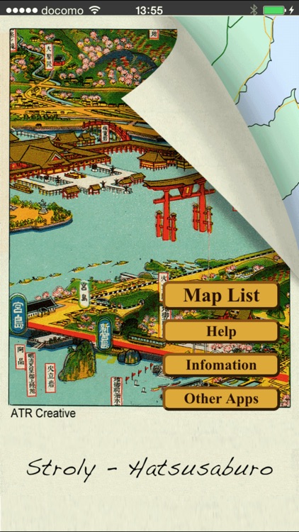
Stroly - Hatsusaburo
by Stroly Inc.

What is it about?
Stroly is the series of apps which features the display of the user's current location on any kinds of historical or illustrated maps.
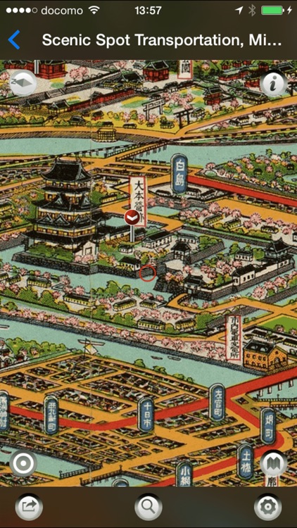
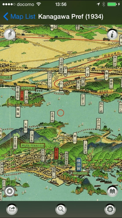
App Screenshots
App Store Description
Stroly is the series of apps which features the display of the user's current location on any kinds of historical or illustrated maps.
"Stroly" means "to stroll around" in Japanese. Please enjoy strolling around with this app. This is the first version of Hatsusaburo Yoshida released from the Stroly series.
[FEATURES of Hatsusaburo Stroly]
20 maps from International Research enter for Japanese Studies are listed in the Hatsusaburo Stroly.
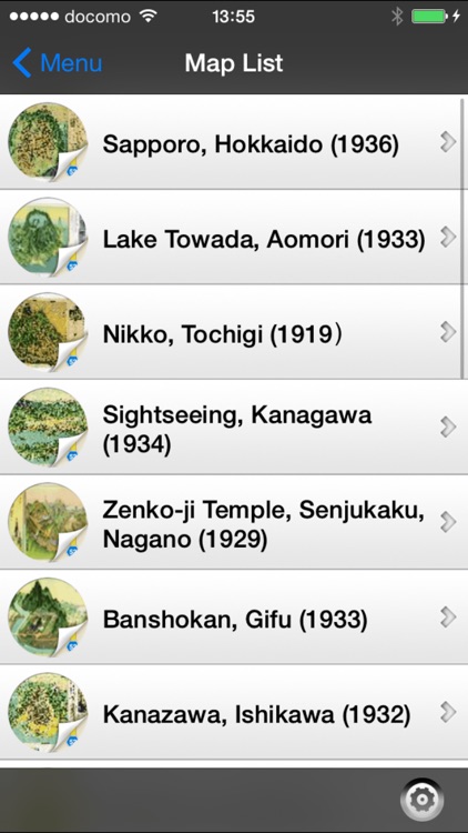
Featured Maps:
- Sapporo, Hokkaido (1936) Bird's-eye View Map of Sapporo City.
- Lake Towada, Aomori (1933) Bird's-eye View Map of Lake Towada.
- Nikko, Tochigi (1919) Scenic Spot Nikko Pictorial Map.
- Sightseeing, Kanagawa (1934) Kanagawa Pref.
- Zenko-ji Temple, Senjukaku, Nagano (1929) Guidance to Senjukaku, Kanbayashi Spa from Zenko-ji Temple.
- Kanazawa, Ishikawa (1932) Bird's-eye View Map in Kanazawa City.
- Banshokan, Gifu (1933) Famous Place Banshokan, Gifu Pictorial Map.
- Nagoya, Aichi (1933) Bird's-eye View Map of Famous Place Transportation, Large Nagoya.
- Ise-Jingu Shrine, Mie (1930) Ise-sangu Pictorial Map with Scenic Spot.
- Mt.Hiei, Kyoto (1926) Pictorial Bird's-eye View Map of Scenic Spot. Transportation,Mt.Hiei.
- Kyoto Famous Places, Kyoto (1928) Bird's-eye View Map in Kyoto City.
- Electricity Expo., Osaka (1926) Electricity Expo.Venue Pictorial Map.
- Osaka, Kinki (1932) Osaka Prefecture traffic rough sketch.
- Horyu-ji Temple, Nara (1921) Scenic Spot Houryu-ji Temple Pictorial Map.
- Kobe・Arima, Hyogo (1928) Scenic Spot Transportation, Shintetsu Arima Line, Pictorial.
- Miyajima, Hiroshima (1928) Scenic Spot Transportation, Miyajima, Hiroshima Pictorial Map.
- Hagi,Yamaguchi (1925)
- Ritsurin Park, Kagawa (1920) Ritsurin Park in Takamatsu.
- Omogo-kei, Ehime (1935) Superb View of Omogo-kei.
- Kyushu (1927) Pictorial Bird's-eye View Map of Grand Kyushu.
[Hatsusaburo YOSHIDA, 1884-1955]
Hatsusaburo Yoshida, the bird's eye view map artist from Kyoto, was active during the tourism boom in Japan before the World War II. His works were commissioned by the train companies, the city offices, the news paper companies and the hotels.
Throughout his life, he made more than 3,000 maps and was known as the Hiroshige of his age, who was the most famous Japanese ukiyo-e artist.
In his beautiful maps, he often placed Mt. Fuji in the backgrounds.
Still this day, these maps are popular among his fans.
(This information is based on Japanese Wikipedia)
[App Features]
The user's current location shows up on a variety of bird's-eye view maps.
Indicated current location moves, which provides the users with the experience of strolling around in bird's-eye view maps. By touching a landmark icon displayed on the map, the user can view photos of the landmark from the same period as the map.
The bird's-eye view maps can be switched to Standard Maps.
[NOTICE]
1. Stroly shows your location using GPS. Using Stroly on iPod
Touch or iPad WiFi might not show accurate current position.
2. No modification is done to the description of original maps used in
this app.
3. We cannot guarantee 100% accuracy of the maps and locations because of the distortion of the original maps and the GPS accuracy. We would like you to enjoy the original uncertainty of the historical maps.
We have no intention of violating human rights by disclosing the historical maps.
Disclaimer:
AppAdvice does not own this application and only provides images and links contained in the iTunes Search API, to help our users find the best apps to download. If you are the developer of this app and would like your information removed, please send a request to takedown@appadvice.com and your information will be removed.
AppAdvice does not own this application and only provides images and links contained in the iTunes Search API, to help our users find the best apps to download. If you are the developer of this app and would like your information removed, please send a request to takedown@appadvice.com and your information will be removed.