You are using an outdated browser. Please
upgrade your browser to improve your experience.
A popular application of the handheld devices is to make use of the built-in Map to measure distances and areas

Area - Distance
by CORVALLIS MICROTECHNOLOGY, INC.

What is it about?
A popular application of the handheld devices is to make use of the built-in Map to measure distances and areas. You may have been resigned to accepting the rough results for the lines and areas you digitize by using your finger tip or a capacitive stylus. Now, you can experience exciting digitization precision with the “Area - Distance” app. You will be able to do the following using the Area - Distance app on your iPAD, iPhone or iPod touch:
App Screenshots
App Store Description
A popular application of the handheld devices is to make use of the built-in Map to measure distances and areas. You may have been resigned to accepting the rough results for the lines and areas you digitize by using your finger tip or a capacitive stylus. Now, you can experience exciting digitization precision with the “Area - Distance” app. You will be able to do the following using the Area - Distance app on your iPAD, iPhone or iPod touch:
* Precisely digitize Points, Lines and Areas and save them as Features.
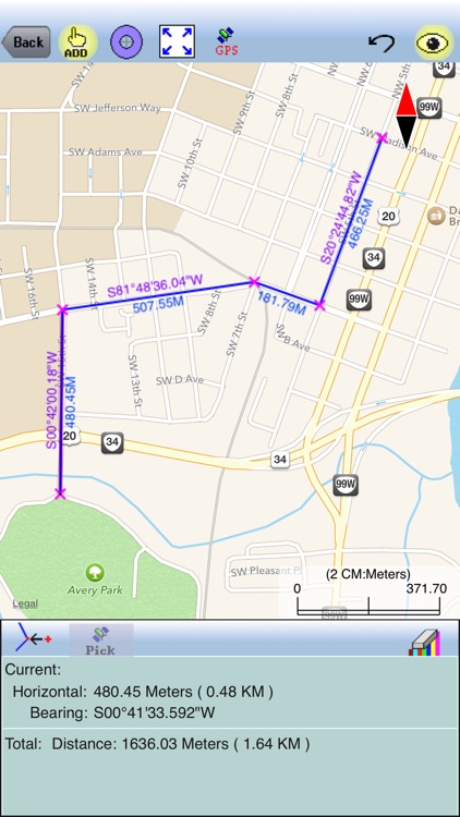
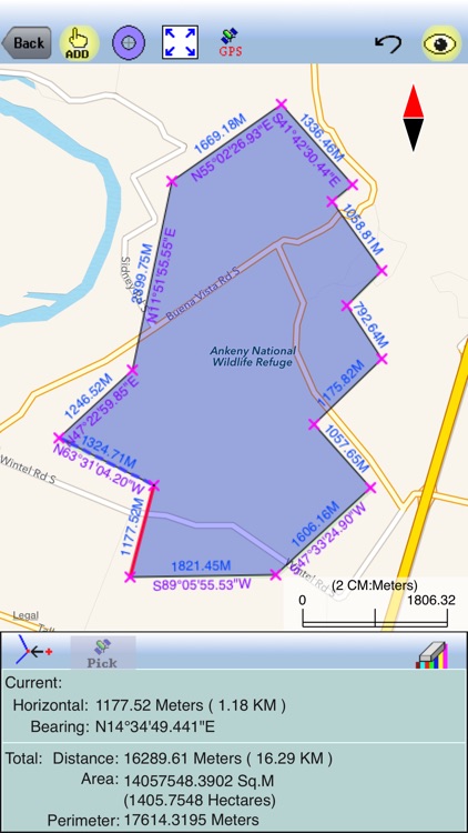
* View position, length or area values for the saved Features.
* Label the Lines with segment lengths and directions as well as corner angles.
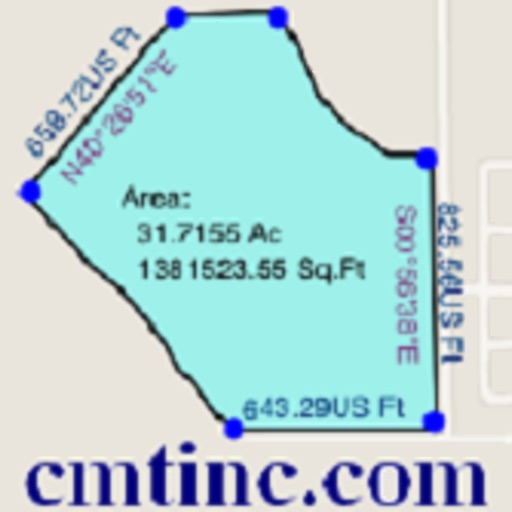
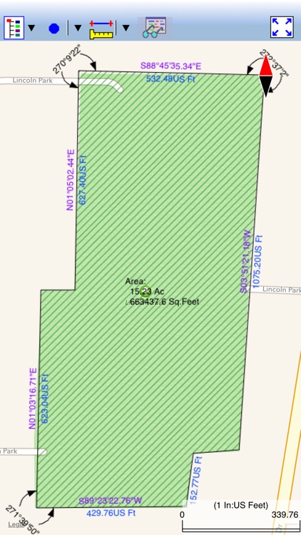
* Label the Areas with size in acres and square feet or hectares and square meters.
* Measure distances and areas without saving the shapes.
* Move existing nodes to fine-tune the map drawing.
* Create Points from entered coordinates.
* Create Points from an imported text file.
* Create a Point or record a node by picking the GPS location.
* Search a location by address or by coordinates.
* Save the job data file for later use.
* Output the drawing and the coordinates to PDF.
* Email the job data files and the PDF files to your colleagues.
The Area - Distance app comes with a detailed built-in help document.
Please note: Location data depends on the GPS receiver used. Continued use of GPS running in the background can dramatically decrease battery life. This app will let you easily toggle the built-in GPS on or off.
Disclaimer:
AppAdvice does not own this application and only provides images and links contained in the iTunes Search API, to help our users find the best apps to download. If you are the developer of this app and would like your information removed, please send a request to takedown@appadvice.com and your information will be removed.
AppAdvice does not own this application and only provides images and links contained in the iTunes Search API, to help our users find the best apps to download. If you are the developer of this app and would like your information removed, please send a request to takedown@appadvice.com and your information will be removed.