You are using an outdated browser. Please
upgrade your browser to improve your experience.
The Cartograph app views Mapsforge offline vector maps, offline raster maps, and online/WMS maps

Cartograph 2 Maps
by Harald Meyer
What is it about?
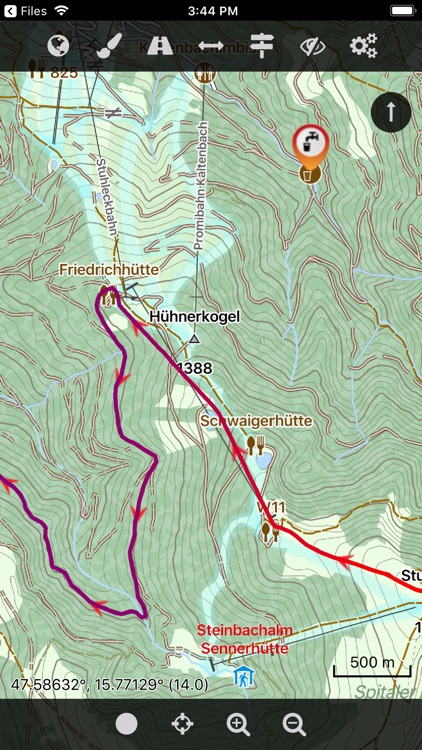
The Cartograph app views Mapsforge offline vector maps, offline raster maps, and online/WMS maps. It supports tracking, route search, overlays, hillshading, reliefs, track drawing, and has many other features.
App Screenshots
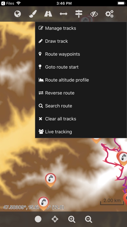

App Store Description
The Cartograph app views Mapsforge offline vector maps, offline raster maps, and online/WMS maps. It supports tracking, route search, overlays, hillshading, reliefs, track drawing, and has many other features.
Cartograph Maps 3 is available here: https://www.cartograph.eu/v3/
### Features ###
- User interface languages: Dutch, English, French, German, Italian, Russian, Spanish, Traditional Chinese.
- View Mapsforge offline vector maps (including v5 format).
- Full support for Mapsforge styling/render themes (including hillshading) and layers.
- Offline raster maps: Locus SQLite maps, MBTiles, TwoWays/CompeGPS RMAP*, Oruxmaps SQLite*.
- Online map support (including WMS - Web Map Service maps), e.g. OpenStreetMap, OpenCycleMap, OpenSeaMap, WikiMedia hillshading, etc.
- Import online maps easily from files: "http://www.cartograph.eu/help_onlinemapimport".
- Offline hillshading (from HGT elevation data).
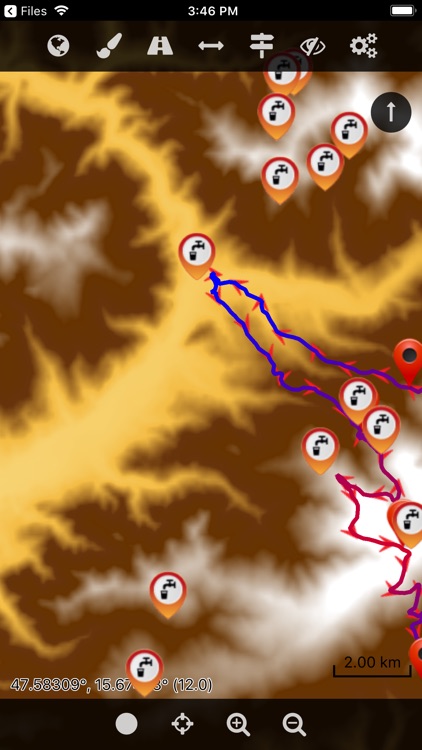
- Offline relief shading.
- Offline slope maps (experimental).
- Contour lines (Mapsforge maps).
- Worldwide, free offline maps.
- Support for Mapsforge multi-maps (multiple .map files stitched into a single map).
- Night/day mode.
- GPS Track recording.
- Manual track drawing and editing.
- GPX import and export (basic KML/KMZ import support).
- Import of photos with EXIF tags as waypoints.
- Import of KMZ photo series.
- Import Google Maps POIs/Places using Google Takeout data export function.
- Upload tracks to Strava.com.
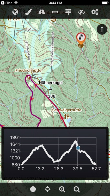
- Route altitude profile and elevation/slope visualization.
- Online route search.
- Live tracking and polling (using custom server, GPSies.com, or Cartograph server).
- Support for Mapsforge POIs, offline POI search, and dynamic POI loading.
- Scalable interface (e.g. to increase button sizes).
- Compass.
- Units: Celsius, Kelvin, Fahrenheit, metric, imperial, nautic.
- Decimal and degree coordinate modes.
- Supports Mapsforge multi-language maps and POIs.
- Map import: iOS 11 File Browser, Wifi upload, iTunes file sharing, internal download manager, and import using "Open in" from 3rd party apps like Safari, Chrome, DropBox, etc.
- Voice/sound alerts along routes and waypoints. *EXPERIMENTAL*
- WaterSupply.at drinking water sources.
- Customizable user interface color (dark, light, and colors) and size.
- 3D map snapshot view for an overview over the current map region.
* RMAP and Oruxmaps use various map projections and support is experimental. Please contact us if a map does not work so that we can add support for your projection.
Further information: http://www.cartograph.eu
Getting started: https://www.cartograph.eu/gettingstarted
Help&Tutorial: https://www.cartograph.eu/docs
Facebook: https://www.facebook.com/Cartograph.eu/
User manual: http://www.cartograph.eu/downloads/usermanual_en.pdf
YouTube how-to videos: https://www.youtube.com/watch?v=dn9EOg5h3yY&list=PLP8X6xYv-qCz46hplsfGLW1LNgywBZrTk
Please drop us a line if you have questions or feature requests: http://www.cartograph.eu/contact
### Maps ###
- Offline Map Downloader (https://www.tequnique.com/offlinemapdownloader)
- OpenAndroMaps.org: very good maps for outdoor activities.
Disclaimer:
AppAdvice does not own this application and only provides images and links contained in the iTunes Search API, to help our users find the best apps to download. If you are the developer of this app and would like your information removed, please send a request to takedown@appadvice.com and your information will be removed.
AppAdvice does not own this application and only provides images and links contained in the iTunes Search API, to help our users find the best apps to download. If you are the developer of this app and would like your information removed, please send a request to takedown@appadvice.com and your information will be removed.