You are using an outdated browser. Please
upgrade your browser to improve your experience.
mKart 3D marine App is for safe and comfortable navigation

mKart Marine Navigation
by GEOPHONE GROUP INTERNATIONAL Oy
What is it about?
mKart 3D marine App is for safe and comfortable navigation.
App Screenshots
App Store Description
mKart 3D marine App is for safe and comfortable navigation.
Product Highlights:
WEB CONSOLE:
E-shop;
ENCs and cartographic products Catalogue;
Portfolio optimization;
Fleet management;
Roots and tracks;
Data exchange;
Accounting;
SAFETY IS IN FOCUS:
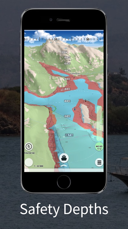
Automatic routing and NO-GO Area display;
Dangerous depths and objects automatic control.
Safe sailing alternative and recommendations;
Meeting points and hazardous traverses calculations.
Background monitoring: dangers’ and ships’ alerts, all along the route.
Apple watch support.
DOCKING:
Click on the chart, select the location and follow the docking path.
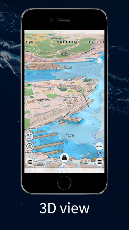
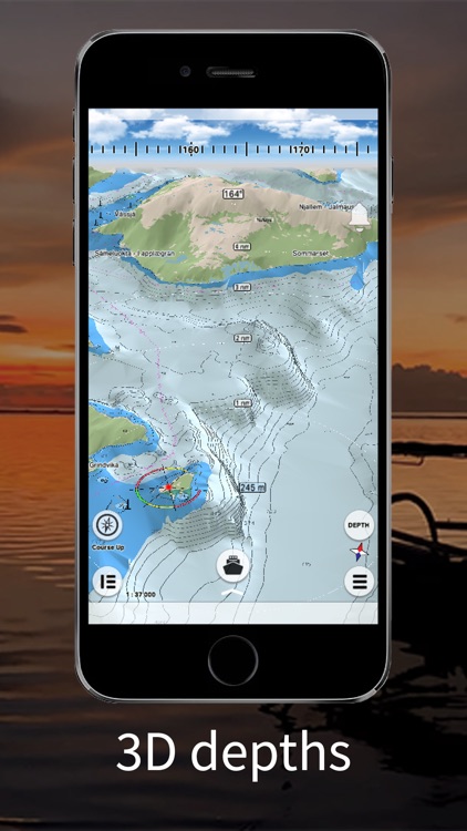
3D MARINE AND OSM CHARTS:
3D marine and OSM charts are uploaded and displayed automatically. 3D sea floor, land’s relief, 3D buildings, ships and infrastructure models contribute to better seafarers orientation and awareness.
FREE NOAA ENCs:
Online NOAA nautical charts are being installed automatically via Internet by customer’s position or while browsing and stored for off-line use. Updating is performed in the same way.
SMART PANELS:
Swipe from below and from side to side. Profiles of seabed relief, safety path simulator, docking.
MARINE ROUTE PLANNER:
Save time with integrated sea and river auto routes functionality. Safety checks is implemented along with route monitoring functionality and warning system.
NO GO ZONE:
Display safety area is filled up graphically on the sea map by only safe depth. Safety zone is calculated trough 3D sea bottom model.
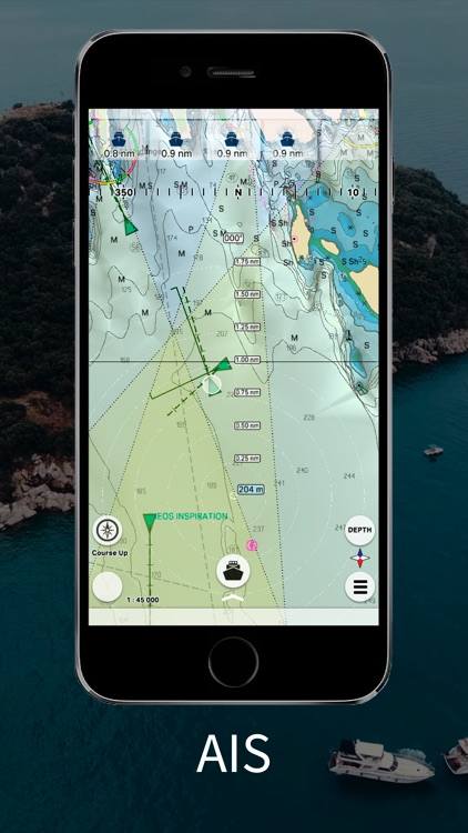
MARINE TRAFFIC:
Marine traffic data can be obtained from open AIS streams over Internet to display and identify dangerous targets.
COMPASS MODE:
Get a quick look around while boat navigation with advanced VR option for better orientation and using visual aids for navigation effectively.
SEARCH:
Search all objects and information on ENC S-57 charts trough SW and data via universal search function.
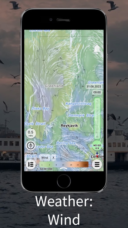
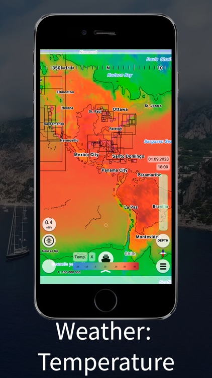
MARINE WEATHER:
mKart online services allows to deliver highly detailed weather information and forecast.
TRACKS AND WAYPOINTS:
PLT and GPX import and export, recording and displaying on the chart.
Disclaimer:
AppAdvice does not own this application and only provides images and links contained in the iTunes Search API, to help our users find the best apps to download. If you are the developer of this app and would like your information removed, please send a request to takedown@appadvice.com and your information will be removed.
AppAdvice does not own this application and only provides images and links contained in the iTunes Search API, to help our users find the best apps to download. If you are the developer of this app and would like your information removed, please send a request to takedown@appadvice.com and your information will be removed.