You are using an outdated browser. Please
upgrade your browser to improve your experience.
NAHRIM Sea Level Rise Apps (SLRAPP) shows data collection of projection sea level rise for Malaysia until certain years

NAHRIM SLR Projection
by National Hydraulic Research Institute of Malaysia (NAHRIM)

What is it about?
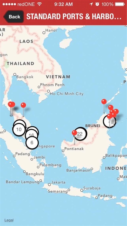
NAHRIM Sea Level Rise Apps (SLRAPP) shows data collection of projection sea level rise for Malaysia until certain years. The data will be used to monitor of coastal protection structures including Port and Harbor and also analyze potential impact due to Sea Level Rise.
App Details
Version
1.5
Rating
NA
Size
65Mb
Genre
Weather Education
Last updated
August 28, 2015
Release date
May 7, 2015
More info
App Screenshots
App Store Description
NAHRIM Sea Level Rise Apps (SLRAPP) shows data collection of projection sea level rise for Malaysia until certain years. The data will be used to monitor of coastal protection structures including Port and Harbor and also analyze potential impact due to Sea Level Rise.
Disclaimer:
AppAdvice does not own this application and only provides images and links contained in the iTunes Search API, to help our users find the best apps to download. If you are the developer of this app and would like your information removed, please send a request to takedown@appadvice.com and your information will be removed.
AppAdvice does not own this application and only provides images and links contained in the iTunes Search API, to help our users find the best apps to download. If you are the developer of this app and would like your information removed, please send a request to takedown@appadvice.com and your information will be removed.