Google Maps for iOS Updated, Apple Maps Set to Use Drones
We’ve got a twofer for you today on the mapping app news front. First off, there’s Google Maps, whose official iOS app has just been updated with a couple of new and notable features. And then there’s Apple Maps, which is reportedly set to carry out a couple of major developments.

Google Maps
 Google Maps
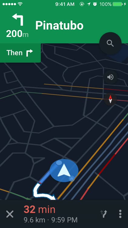
This time, the app has been updated with the ability to search for places along a route and a new widget for nearby traffic.

Search along your route

While using turn-by-turn directions to your set destination, you can search for places along your route, perhaps for a quick stop for coffee or a refill at a gas station. Just tap the magnifying glass icon to access shortcuts for searching for gas stations, restaurants, grocery stores, and coffee shops, or to do a specific text or voice search.
Nearby Traffic widget

In addition to the widgets for nearby transit and travel times, you can enable the widget for nearby traffic to quickly access information about the current traffic conditions in your area from the Notification Center. This includes descriptions (e.g. “Moderate traffic in your area”) and indications of incidents and possible delays (e.g. “with delays up to 26 min”). The Nearby Traffic widget includes a mini map that gives a color-coded overview of the traffic conditions, which you can expand by tapping Show More at the top right corner of the widget. Tapping anywhere on the widget’s main content opens the Google Maps app with a larger version of the traffic conditions map.

To start using these new features, get the latest version of Google Maps for iOS, which is free to download from the App Store for iPhone, iPod touch, and iPad.
Apple Maps
As for Apple Maps, a new report claims that it’s about to make significant new steps toward overtaking, or at least catching up with, Google Maps. According to Bloomberg (citing unnamed sources familiar with the matter), Apple plans to improve its mapping service by using drones and implementing indoor navigation features.
Drones
Much like Google Maps, Apple Maps currently employs vans equipped with cameras and sensors to gather mapping data. But it’s reportedly set to start flying drones to capture a broader range of data in a much faster time frame.
To that end, Apple is said to be forming a team of experts in robotics and data collection, at least one of which has been hired from the group in charge of Amazon’s Prime Air drone delivery program.
Using drones, Apple will be able to collect data concerning such things as street sign information and road changes, which will then be used by the Apple Maps team to quickly perform the necessary updates to the mapping service.
Indoor navigation features
Apple acquired WiFiSLAM in 2013 and Indoor.io in 2015. Both startups boasted expertise in indoor navigation. Now, it appears that Apple is set to put that expertise to good use in Apple Maps.
More on WiFiSLAM
New Apple Maps features are reportedly being developed to offer markedly improved navigation in indoor locations, particularly within airports, museums, and other buildings and structures given to holding high traffic.
Improved indoor navigation, along with a new feature designed to guide drivers in changing lanes, is said to be released as early as next year.
